Agricultural region of the Eurasian Steppe (likely Russia, Ukraine, or Kazakhstan).
2026-06-12 16:39:11
Primary guess
Agricultural region of the Eurasian Steppe (likely Russia, Ukraine, or Kazakhstan).
Confidence
• Level: Low
• Why:
- The landscape features highly generic characteristics common to vast, flat agricultural regions found in many parts of the world.
- There are no unique landmarks, signage, architectural styles, or specific plant species that would allow for precise localization.
- The appearance of power lines crossing vast fields is a ubiquitous feature of industrial-scale grain farming globally, from North America to Central Asia.
Visual evidence
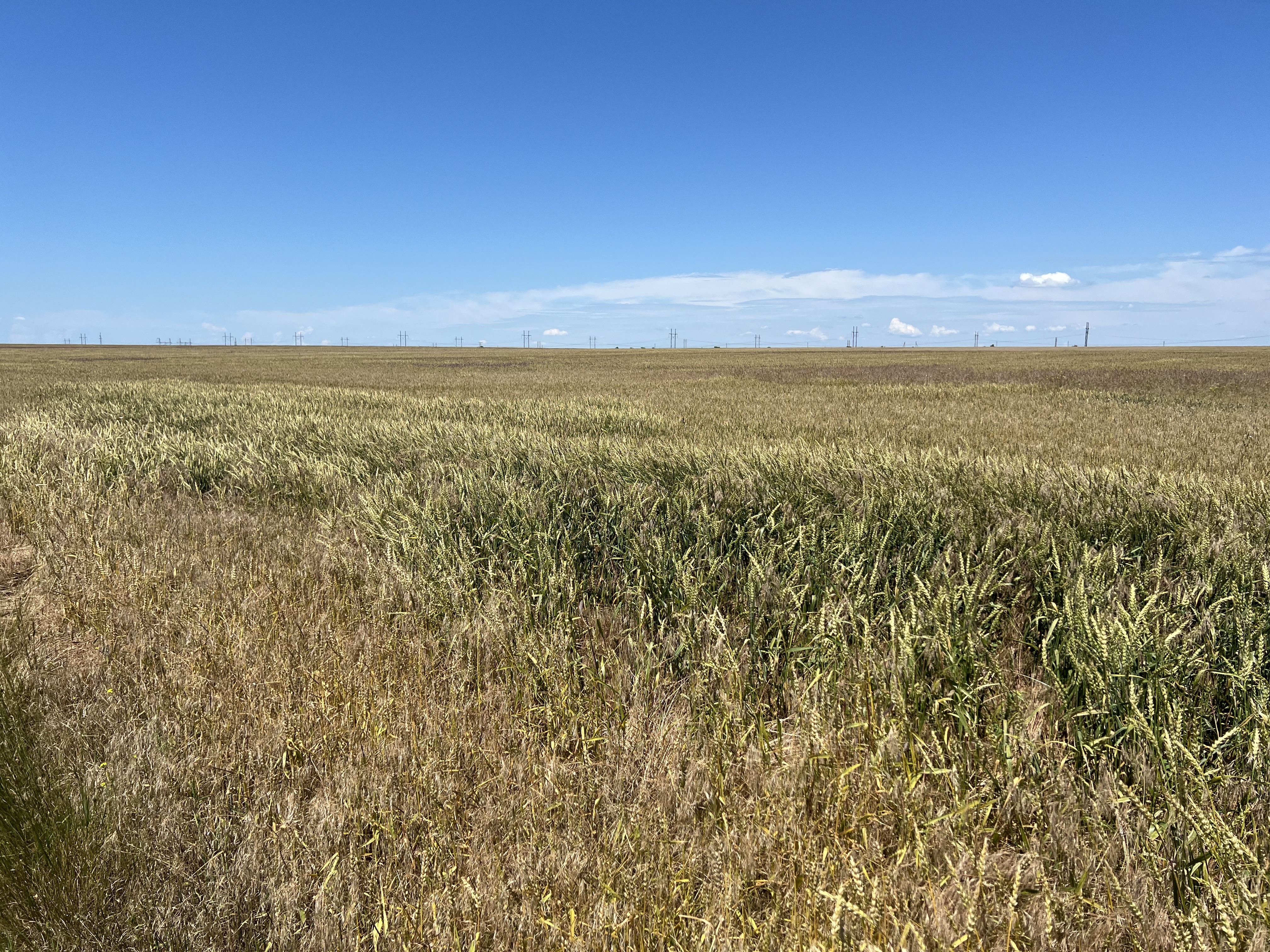
* **Topography:** The land is exceptionally flat, extending to a distant horizon without significant elevation changes or major geographical features, characteristic of steppe or prairie environments.
* **Agriculture:** The field appears to be a large-scale cereal grain crop (wheat or similar). The variation in color from golden to green suggests uneven ripening or perhaps a mixture of crops/grasses, common in large-scale farming.
* **Infrastructure:** High-voltage transmission towers with overhead lines run in a straight, uninterrupted line across the horizon. These are standard lattice-steel structures found globally.
* **Climate:** The clear blue sky and bright, direct sunlight suggest a dry or temperate climate with high visibility, typical of mid-latitude continental interiors during the summer months.
* **Lack of human markers:** The absence of trees, fences, roads, or buildings in the immediate field of view prevents narrowing the location down to a specific country or province.
Reasoning
The visual characteristics of this photograph—vast, flat, open fields of grain, a clear blue sky, and a line of high-voltage transmission towers—are archetypal of major grain-producing regions of the world. Similar landscapes can be found in:
* **The Eurasian Steppe:** Spanning across Southern Russia, Ukraine, and Kazakhstan. This is a very strong candidate due to the vast, uninterrupted scale and the specific style of the transmission infrastructure.
* **The North American Great Plains:** Specifically parts of the U.S. Midwest or the Canadian Prairies.
* **The Pannonian Basin:** Parts of Hungary or Romania.
Because there are no specific identifiers such as mountain silhouettes, unique pylon designs, crop types that are geographically restricted, or road markings, it is impossible to confirm the location with certainty. The visual evidence strongly points toward a large-scale, mechanized agricultural zone in a mid-latitude continental region.
Verification
* The scene matches the visual profile of "vast agricultural landscapes with transmission lines" commonly found in image databases for regions like the Eurasian Steppe.
* Reference to global agricultural infrastructure shows that these elements (wheat fields, lattice power pylons, and flat horizons) are not unique to any single country.
Links
* Agricultural regions of the Eurasian Steppe (Wikipedia)
* General landscape photography of power lines in wheat fields (Stock Examples)
Coordinates
Approximate coordinates cannot be provided. The image depicts a generic rural agricultural landscape that could exist across millions of square kilometers of the Eurasian Steppe or North American prairies.