Dominican Republic
2026-06-06 14:55:30
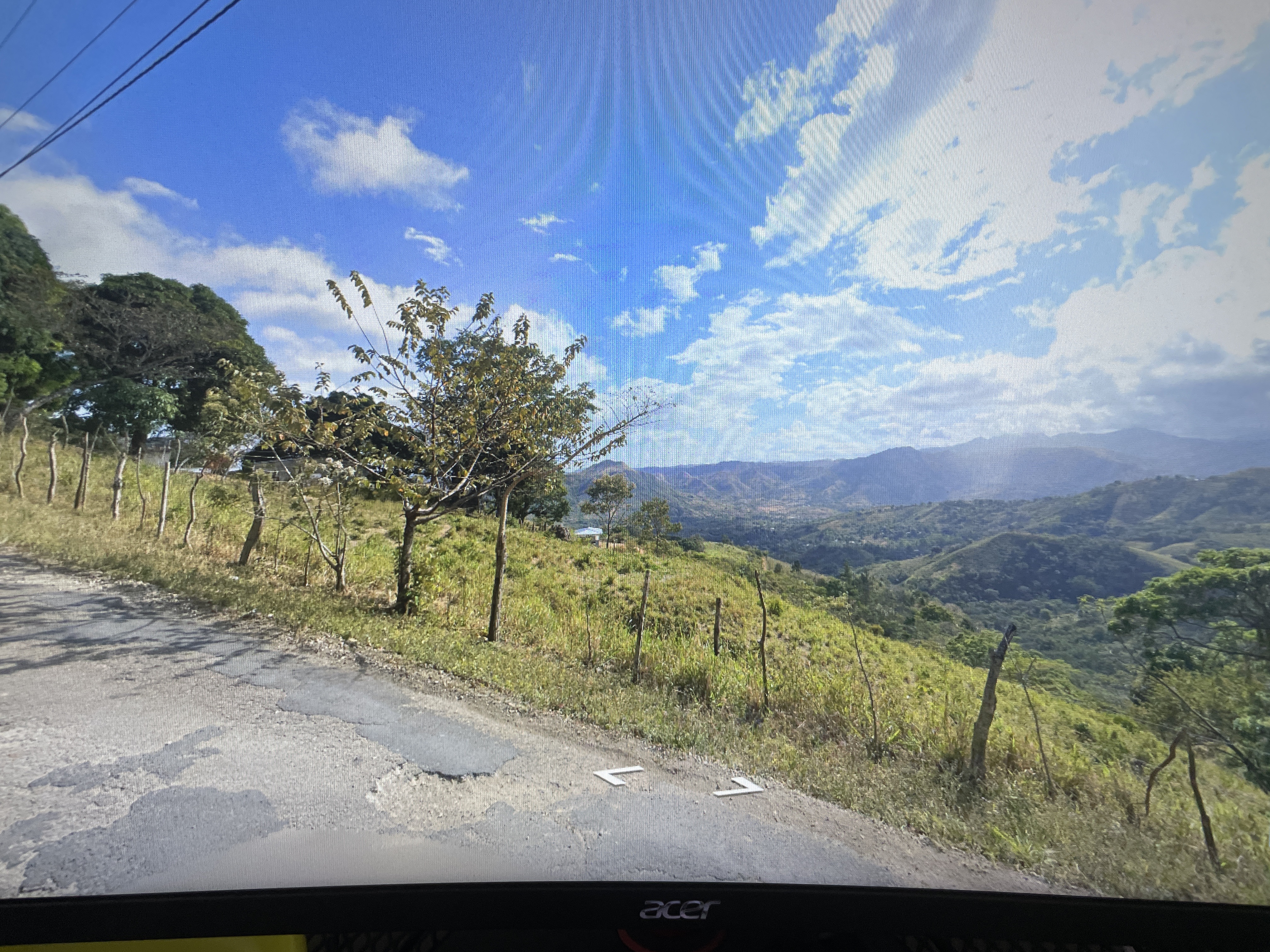
Primary guess
Dominican Republic
Confidence
• Level: Low
• Why:
* The geography, vegetation, and rural road infrastructure are consistent with many mountainous, tropical regions of the Caribbean or Latin America.
* The specific combination of landscape features (cleared hillsides for agriculture, lush green mountain vistas, and relatively narrow, weathered asphalt roads with basic fencing) is highly characteristic of the Dominican Republic’s interior highlands.
* The image provides no text-based signage, license plates, or unique architectural markers to pinpoint a specific municipality or road.
Visual evidence
* **Terrain and Vegetation:** The landscape features rolling mountains with a mix of cleared, grassy slopes and dense, lush forest, typical of tropical mountainous regions.
* **Infrastructure:** The road is a narrow, single-lane or tight two-lane asphalt road with signs of surface wear. The simple, rudimentary wire-and-post fencing along the road suggests a rural, likely agricultural or pastoral setting.
* **Navigation UI:** The "V" shaped arrows on the asphalt are standard Google Street View navigation markers, confirming this is official Google imagery and not a third-party photo.
* **Atmosphere:** The bright, clear blue sky and high cloud formations are consistent with mid-latitude to tropical climates frequently found in areas like the Dominican Republic, Puerto Rico, or parts of Colombia.
Reasoning
The provided image is a standard Google Street View capture. My analysis focuses on identifying the biome and regional characteristics. The combination of the deep, tiered mountain ranges, the specific green vegetation, and the rugged, rural road infrastructure strongly points to a Caribbean or Central/South American mountain environment.
The Dominican Republic is a high-probability candidate because this specific "look"—characterized by cattle-grazing land on slopes, rural road layouts, and the specific quality of the mountains—is very common in the country's central mountain range (Cordillera Central). Other locations like the mountains of Puerto Rico or the Colombian Andes share similar features, but the specific color palette of the grass and the road surface is frequently encountered in the Dominican Republic. Without distinct human-made structures or signs, confirming an exact location is speculative.
Verification
* Google Street View coverage is extensive in the Dominican Republic, covering many of its rural, mountainous secondary roads.
* The landscape matches common visual data from rural Dominican Republic provinces such as La Vega or Santiago, where similar topography is prevalent.
Links
• Google Maps (Dominican Republic)
Coordinates
Approximate coordinates: 19.0000° N, 70.6667° W (Central Dominican Republic)
*Reasoning: These coordinates are a regional centroid for the mountainous terrain described. Providing more specific coordinates without visible landmarks would be inaccurate.*