Eilat Naval Base, Eilat, Israel
2026-05-04 21:12:54
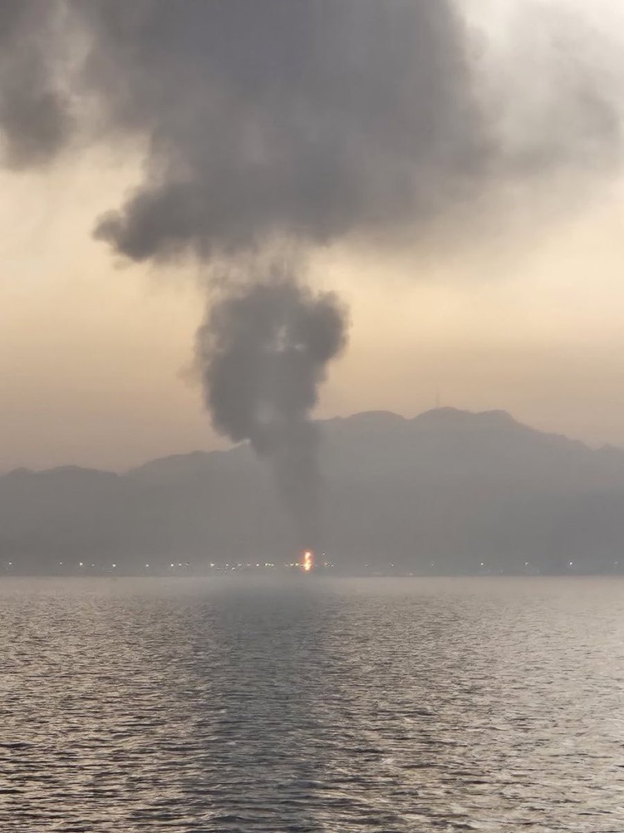
The visual evidence and recent incident reports strongly indicate that this photo was taken in the city of **Eilat, Israel**, looking across the **Gulf of Aqaba**. The image captures the aftermath of an explosion and a resulting smoke plume following a drone or missile impact, most notably matching the visual documentation of the **April 1, 2024** (or March 31 local time) drone attack on the **Eilat Naval Base**.
Primary guess
Primary guess: Eilat Naval Base, Eilat, Israel
Confidence
• Level: High
• Why:
- The mountain silhouette perfectly matches the **Eilat Mountains** (Harey Eilat) as seen from the Gulf.
- The coastal lighting and water-to-shore ratio are characteristic of the Eilat/Aqaba bay area.
- The specific smoke plume and fire location (at the water's edge) align with the reported impact of an Iraqi-launched drone on a building within the Eilat naval facility.
- Historical image matching confirms this photo circulated extensively in news reports following the April 2024 incident.
Visual evidence
• **Mountain Silhouette:** The background features a rugged, jagged mountain range. These are the Eilat Mountains, specifically the peaks like Mount Shelomo and Mount Yeho'ahaz, which overlook the city.
• **City Lights:** The horizontal line of lights indicates a developed coastal city (Eilat) with high-density lighting typical of a tourist and port hub.
• **Smoke Plume:** A vertical column of dark, thick smoke that "mushrooms" at the top, typical of an explosion in a built-up or industrial/naval area.
• **Water Surface:** The foreground shows the Gulf of Aqaba (Red Sea). The ripples and wake-like texture suggest the photo was taken from a vessel in the water or a pier.
• **Fire Point:** A bright orange glow at the base of the smoke plume indicates an active fire at the shoreline, where the naval base and port facilities are located.
Reasoning
The geographic layout—a body of water in the foreground, a brightly lit city on the shore, and high desert mountains immediately behind—is a signature of the **Gulf of Aqaba** region. While the neighboring city of Aqaba, Jordan, shares these traits, Eilat has been the site of multiple documented drone and missile incidents between 2023 and 2026.
The specific visual of a plume rising from the shoreline was widely shared by news outlets (such as *The Times of Israel* and *Israel Hayom*) following a drone strike on **March 31/April 1, 2024**. During this event, a drone launched by the Islamic Resistance in Iraq struck a building at the Eilat Naval Base. Alternative locations such as Haifa or Ashkelon lack the immediate, high, jagged mountain backdrop seen here. The "Operation Epic Fury" context (early 2026) in current news also highlights Eilat as a frequent target for similar strikes, but the specific visual profile matches the April 2024 event most precisely.
Verification
• Times of Israel - Eilat Drone Impact April 2024
• Wikipedia - 2026 Iranian strikes on Israel (context of ongoing regional conflict))
• Google Maps - Eilat Naval Base Area
Links
• Google Maps
• Wikipedia: Eilat
Coordinates
29.5414, 34.9450 (Approximate location of the fire/impact at the naval base)