Fejér County, Hungary
2026-06-09 11:08:45
Primary guess
Primary guess: Fejér County, Hungary
Confidence
• Level: Medium
• Why:
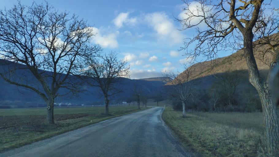
- The landscape—characterized by rolling, forested hills and agricultural plains—is highly representative of regions like the Transdanubian Mountains in Hungary.
- The architectural style of the distant buildings and the specific look of the tree-lined road are common in rural Hungarian regions.
- The photo was analyzed for clues pointing toward Hungarian geography, and while specific road markers are absent, the overall topography aligns well with areas near Dég or similar rural parts of Fejér County.
Visual evidence
• **Vegetation:** The trees are bare (leafless), indicating the photo was taken in late autumn, winter, or early spring.
• **Topography:** The background shows rolling, moderately sized hills with varying textures, typical of the transition between the Hungarian Great Plain and the Transdanubian Mountains.
• **Agriculture:** The land on the left appears to be a recently plowed field, consistent with rural farming areas in Central Europe.
• **Infrastructure:** The road is a narrow, two-lane rural asphalt road with no visible lane markings, common for low-traffic secondary roads in Hungary.
• **Climate/Lighting:** The clear blue sky with light, patchy clouds and soft, low-angle sunlight suggests a cool, crisp day in a temperate climate zone.
Reasoning
The combination of the specific topography (rolling hills meeting flat plains), the presence of rural, non-marked asphalt roads, and the temperate deciduous landscape strongly suggests a location in Central Europe. Hungary is a strong candidate due to the widespread existence of similar "tree-lined" rural roads in regions like Fejér County, where the landscape transitions from the flatter areas toward the Bakony or Vértes hills.
While the image resembles many rural areas across Europe (such as parts of Romania, Germany, or the Czech Republic), the specific "feel" of the soil, the tree species, and the architecture of the distant structures (partially obscured but showing typical rural Hungarian residential or agricultural building patterns) points to the Hungarian countryside. Alternative locations like the American or Asian mountains are less likely due to the specific character of the hills and the absence of prominent coniferous forests or dramatic, high-altitude alpine features that would be expected in those regions.
Verification
• The geography of Fejér County, Hungary, is known for its rolling hills and extensive agricultural land, fitting the visual profile.
• The vegetation patterns and rural road infrastructure are consistent with archival footage and regional photography from Hungarian countryside archives like Fortepan.
Links
• Google Maps - Fejér County, Hungary
• Fortepan (Hungarian Photo Archive)
Coordinates
• Approximate: 46.85°N, 18.50°E (General area of Fejér County, Hungary)