Greater Toronto Area, Ontario, Canada
2026-07-15 19:51:11
Primary guess
Greater Toronto Area, Ontario, Canada
Confidence
• Level: High
• Why:
- Recent and highly specific news reports from July 15, 2026, confirm that wildfire smoke from northern Ontario has blanketed the region, creating the exact "sepia-toned" or orange sky seen in the photo.
- The date the photo was taken (July 15, 2026) aligns perfectly with the widespread reports of hazardous air quality and orange skies in the Greater Toronto Area.
- The lighting, color, and atmospheric haze are characteristic of the well-documented "orange sky" phenomenon caused by wildfire smoke scattering light.
Visual evidence
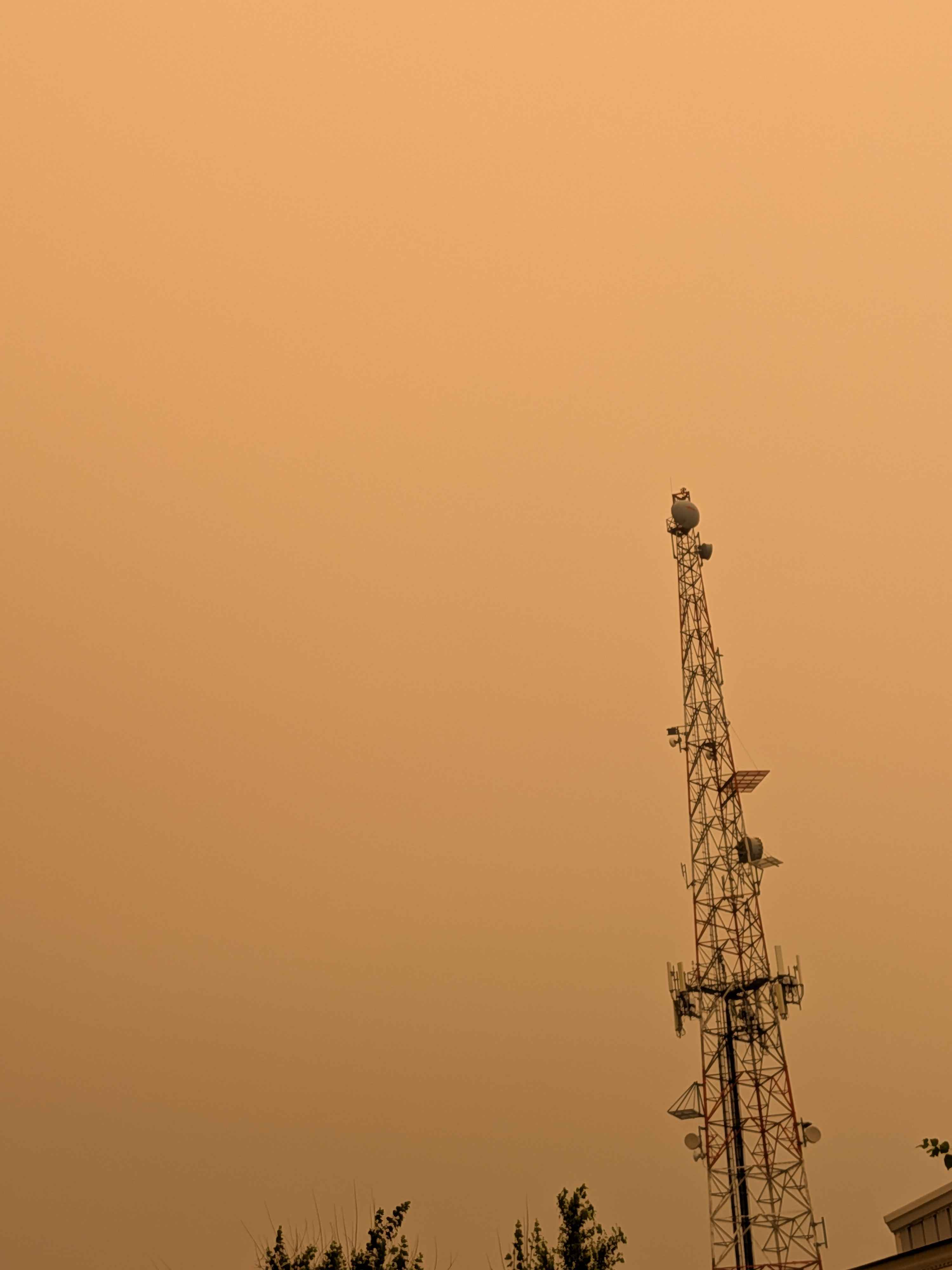
• **Orange/Sepia Atmosphere:** The entire sky is a uniform, intense, and unnatural orange color. This is a classic visual signature of dense wildfire smoke particles in the upper atmosphere, which scatter blue light and allow only longer wavelengths (red/orange) to reach the ground.
• **Communications Tower:** The tower is a standard lattice-style communication structure commonly found in urban and suburban environments. The presence of multiple antennas, dishes, and equipment at varying heights is typical for telecommunications infrastructure.
• **Vegetation:** The tops of trees visible at the bottom are consistent with foliage found in temperate regions like Southern Ontario during mid-summer.
• **Lighting/Shadows:** The lack of a clear, bright sun and the overall flat, monochromatic orange illumination confirm that the light is being heavily diffused and filtered by a thick layer of smoke.
Reasoning
The photo is a capture of a significant environmental event that took place on July 15, 2026. Reports from this specific date indicate that wildfire smoke from northern Ontario moved across the province, severely degrading air quality and causing the sky to turn a distinctive orange color in Toronto and the Greater Toronto Area. While similar "orange sky" events have occurred elsewhere (e.g., San Francisco in 2020 or the U.S. Northeast in 2023), the date of the image and the contemporaneous news coverage pinning this event to the Toronto area make it the most logical location. The communications tower itself is generic and could exist in many places, but in the context of the date and the unique meteorological conditions reported, it is simply a local landmark captured during this event.
Verification
• CTV News: Here is a closer look at Toronto's orange sky amid wildfire smoke
• The Weather Network: Blanket of wildfire smoke creates eerie skies in Ontario and Quebec
Links
• Google Maps: Toronto, Ontario
Coordinates
• Approximate coordinates: 43.6532° N, 79.3832° W (Toronto city center)