Intermountain West, United States
2026-07-30 15:26:21
Primary guess
Intermountain West, United States
Confidence
• Level: Medium
• Why:
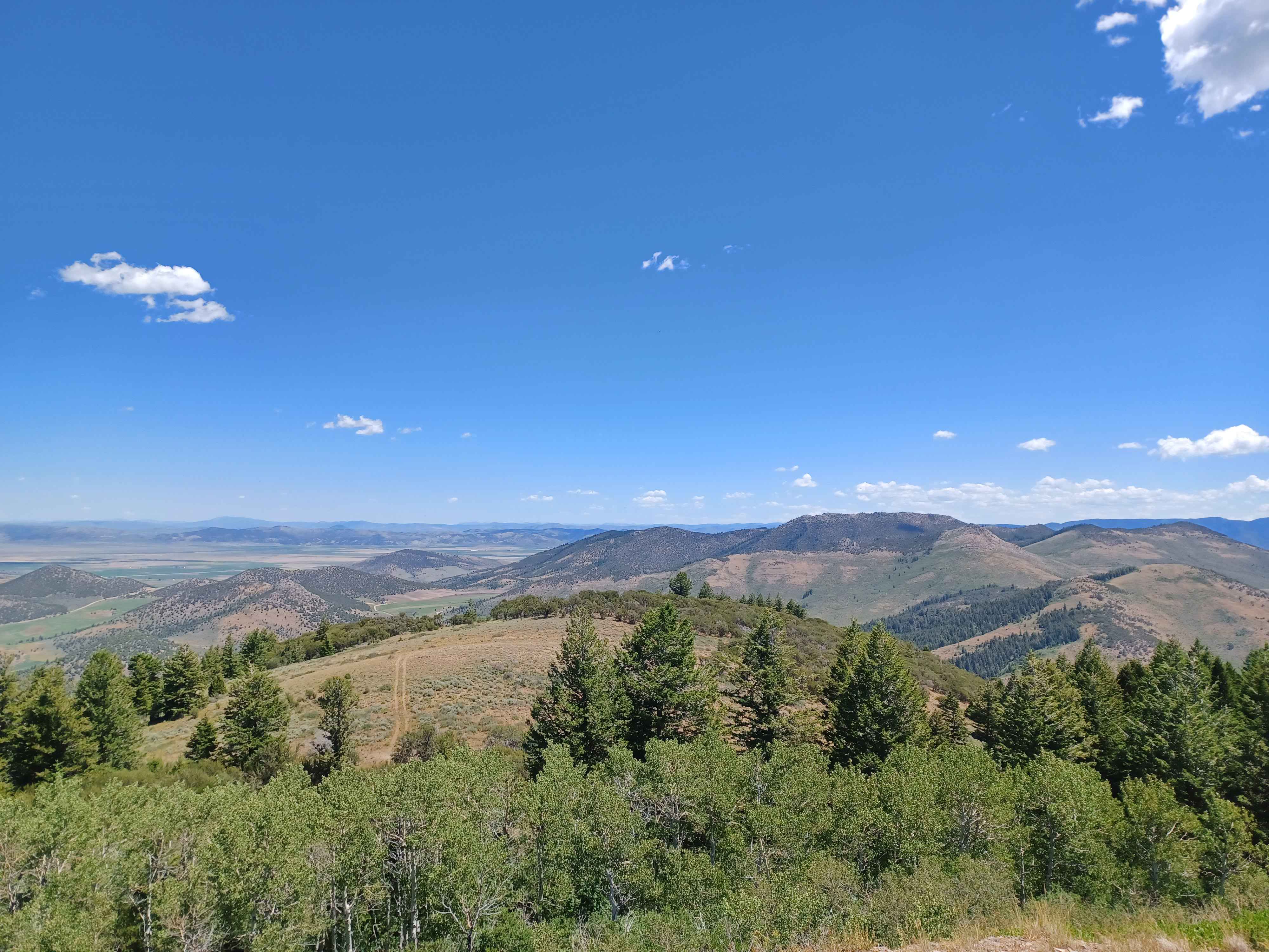
- The landscape features characteristic of the American West are present, including sagebrush-steppe, quaking aspen groves, and dry, mid-elevation mountain ranges.
- This specific combination of topography (broad valleys, rounded foothills, distant ranges) is widespread across the Great Basin and Rocky Mountain regions.
- Without specific landmarks, architectural features, or road signage, narrowing this down to a precise location (e.g., a specific county or range) is speculative, though it strongly resembles areas like Nevada, Utah, Idaho, or Wyoming.
Visual evidence
* **Vegetation:**
* **Quaking Aspen (*Populus tremuloides*):** The vibrant green deciduous trees in the foreground are characteristic of high-elevation, moisture-holding patches in the American West.
* **Conifers:** Dark green evergreen trees (likely pine or fir) are present on the slopes, a typical "mixed-conifer/aspen" forest mosaic.
* **Sagebrush-Steppe:** The light, brownish-grey brush covering the hillsides is consistent with semi-arid "sagebrush steppe," common in the Intermountain West.
* **Topography:**
* The wide, flat valley floor and the rounded, moderately sloped mountain ranges in the distance indicate a landscape shaped by basin-and-range geology or eroded high-elevation plateaus.
* **Climate/Atmosphere:**
* The clear, deep blue sky and the crisp, distant visibility are common in the dry, high-altitude climates of the western United States.
Reasoning
The visual evidence points toward the **Intermountain West** region of the United States. This area, spanning from the eastern slopes of the Sierras to the Rockies, features this exact ecological profile: high-elevation basins dominated by sagebrush, punctuated by aspen-conifer forests in moister drainage areas.
* **Why not more specific?** The photo lacks man-made structures (roads, buildings, power lines) that would allow for a definitive "pin" on a map. Many mountain ranges in Nevada (e.g., the Ruby Mountains), Utah (e.g., the Wasatch Plateau), and Idaho (e.g., the Owyhee region) share this exact appearance.
* **Alternative possibilities:** While similar landscapes exist in parts of the Southern Interior of British Columbia or parts of the Southern Andes, the specific mix of vegetation (notably the extensive sagebrush and aspen) is a hallmark of the Great Basin and surrounding mountain systems in the U.S.
Verification
* **Vegetation Patterns:** Research on aspen distribution and the sagebrush steppe confirms this ecosystem's prevalence across the Intermountain West.
* **Geological Context:** The basin-and-range topography visible here is consistent with standard geological surveys of regions like Northern Nevada and Southern Idaho.
Links
• Western Aspen Alliance
• Intermountain Basins Big Sagebrush Shrubland (NatureServe/Guide to Colorado)
Coordinates
• **Approximate:** 40°N to 43°N, 110°W to 118°W (Broad range covering typical Intermountain West landscapes). Precise location cannot be determined without visual landmarks.