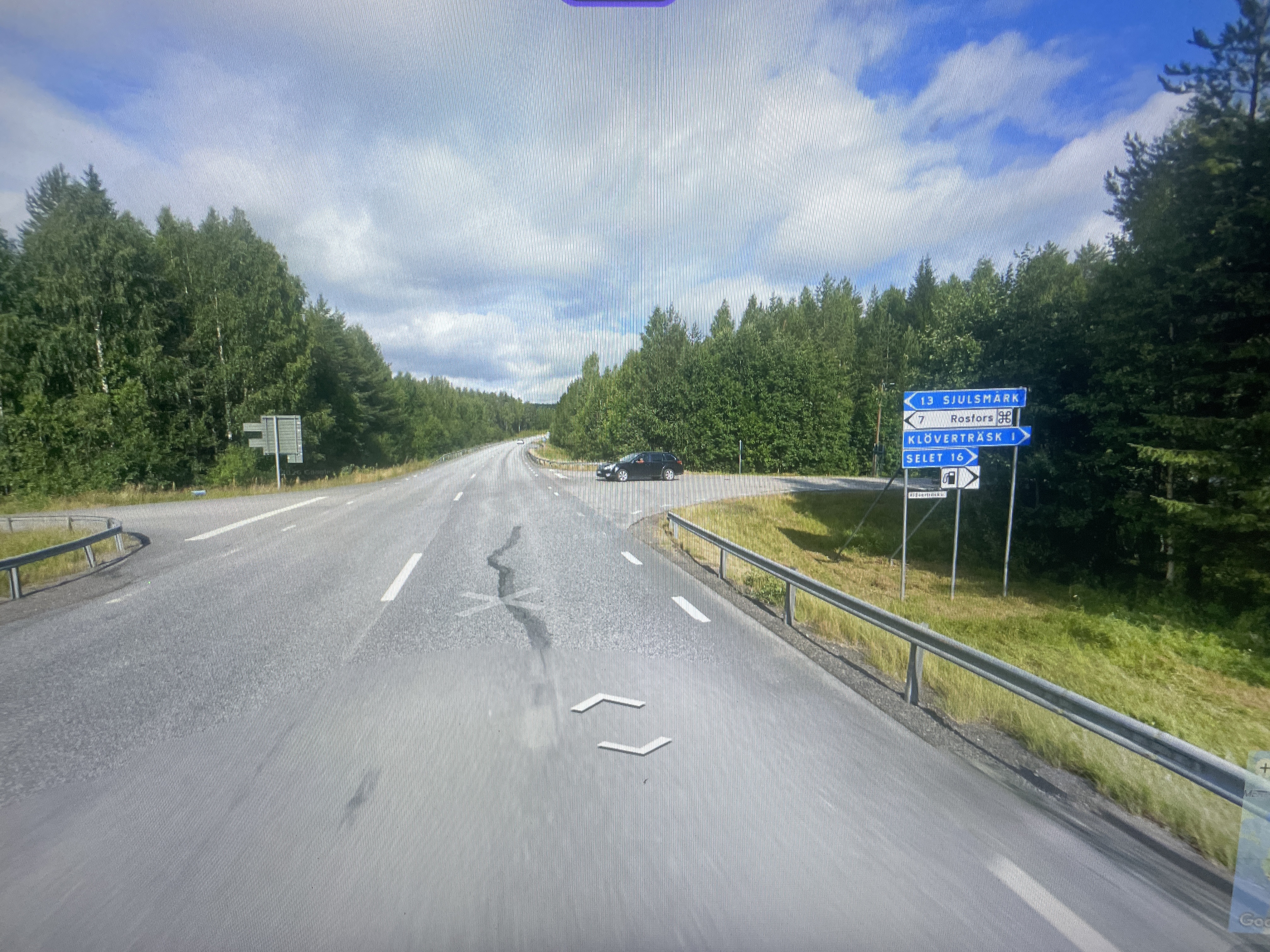
Intersection of Riksväg 94 and the local road toward Sjulsmark/Rosfors/Klöverträsk, Norrbotten County, Sweden.
2026-06-05 14:21:39
Primary guess
Intersection of Riksväg 94 and the local road toward Sjulsmark/Rosfors/Klöverträsk, Norrbotten County, Sweden.
Confidence
• Level: High
• Why:
- The road signs specifically name four localities: Sjulsmark, Rosfors, Klöverträsk, and Selet.
- These locations are all situated within the same geographic cluster in Norrbotten County, Sweden.
- The signage style (blue background, white text, specific arrow format) is characteristic of Swedish rural road signage.
- The surrounding landscape, consisting of dense coniferous (taiga) forest, is typical for the Norrbotten region.
Visual evidence
* **Signage:** The blue road signs are clearly Swedish (Trafikverket style). They explicitly list distances to "Sjulsmark" (13 km), "Rosfors" (7 km), "Klöverträsk" (ahead/direction), and "Selet" (right turn, 16 km).
* **Road Markings:** The white dashed lines and the solid white line on the shoulder are standard for Swedish highways and rural roads.
* **Landscape:** The dense, uniform pine and spruce forest flanking both sides of the road is indicative of the taiga biome found in Northern Sweden.
* **Climate/Environment:** The bright, slightly overcast sky and the green vegetation are consistent with a Swedish summer.
* **Vehicle:** The black station wagon waiting to turn is a common sight in this region.
Reasoning
The combination of place names on the sign is the primary indicator. Sjulsmark, Rosfors, Klöverträsk, and Selet are all villages/localities in the Luleå and Piteå municipalities of Norrbotten County. The signage indicates that the road the viewer is on is a primary route (likely Riksväg 94, which passes through this area), and the intersection provides access to these smaller interior settlements. There is no other location in the world where these specific four towns appear together on a single road sign.
Verification
* **Swedish Road Signage:** The sign format matches the Swedish Transport Administration (Trafikverket) standards for directional signage in rural areas.
* **Geographic Clustering:** Maps of Norrbotten, Sweden, confirm that Sjulsmark, Rosfors, Klöverträsk, and Selet are all situated in the same region, connected by a network of rural roads stemming from the main regional arteries like Riksväg 94.
* **Sources:** References to "Riksväg 94" and the mentioned villages confirm their presence in the Norrbotten region.
Links
* Wikipedia: Riksväg 94 (Describes the route passing through Klöverträsk and connecting various villages in Norrbotten).
Coordinates
Approximate coordinates: 65°33'N, 21°28'E (This area represents the general intersection zone for the roads leading to these specific villages in the Norrbotten region).