Jalisco, Mexico
2026-06-04 21:02:55
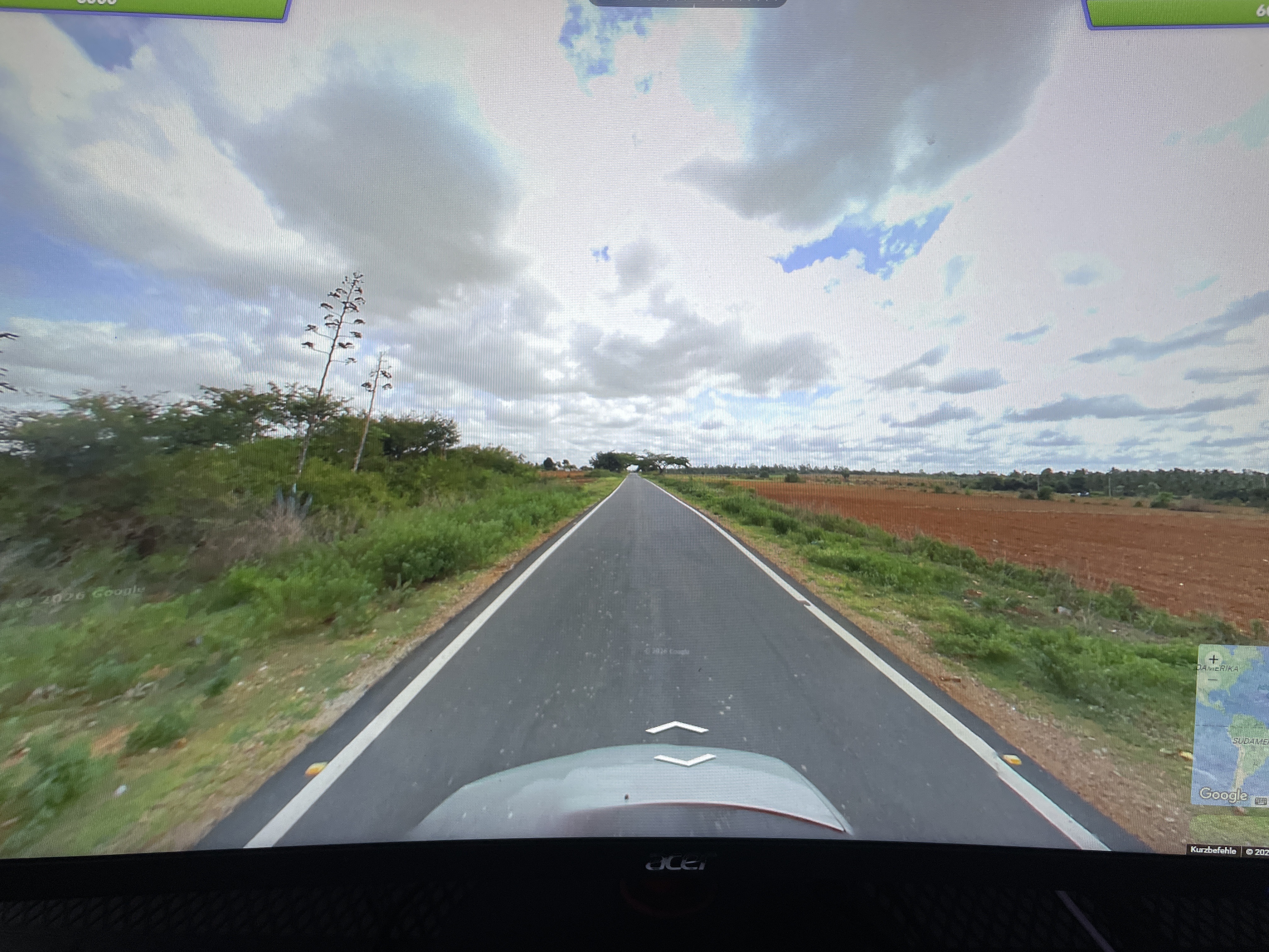
Primary guess
Jalisco, Mexico
Confidence
• Level: Medium
• Why:
- The presence of agave plants, which are iconic to the landscapes of Jalisco, Mexico, strongly suggests this region.
- The red soil (laterite or iron-rich earth) is a characteristic geological feature often associated with the agave-growing highlands of Jalisco.
- The road infrastructure, including the paving and markings, aligns with rural agricultural regions in Mexico.
- The "Kurzbefehle" text in the Google Maps interface indicates the user's browser or system is set to German, which is a common language for many European tourists or expats, but it does not dictate the location of the photograph itself.
Visual evidence
* **Agave plants:** Visible on the left side, these are a primary indicator of the Mexican agave-tequila landscape, specifically in the state of Jalisco.
* **Red soil:** The stark contrast of the vibrant red/orange earth on the right side of the road is highly characteristic of the soil composition in certain parts of central Mexico.
* **Rural Road:** A well-paved, narrow two-lane road without heavy infrastructure, typical of rural agricultural corridors.
* **Vegetation:** The surrounding shrubs and trees are consistent with a semi-arid, Mediterranean-like, or tropical-highland climate often found in Mexican agricultural zones.
* **Google Interface:** The "Kurzbefehle" (shortcuts) label in the bottom-right corner confirms the user is navigating via a German-language interface, which is a UI setting and not a geographic clue.
Reasoning
The visual combination of agave plants and deep red soil is a hallmark of the Tequila-producing regions of Jalisco, Mexico. While similar environments exist elsewhere—such as parts of Southern France or Mediterranean regions—the specific variety of agave and the scale of the agricultural fields point most strongly to Mexico. The road's appearance is typical of the regional highways used to transport agave or serve rural communities. Alternative locations like the Mojave Desert are less likely due to the specific species of vegetation and the soil color. The German text in the corner is simply a translation of the "Keyboard shortcuts" menu available in Google Maps for any user.
Verification
* Agave landscapes in Jalisco, Mexico
* Soil and vegetation typical of Jalisco tequila regions
Links
Coordinates
Approximate location: 20.8°N, 103.7°W (Central Jalisco, Mexico, in the region of Tequila)