Max Patch, North Carolina
2026-07-15 05:46:52
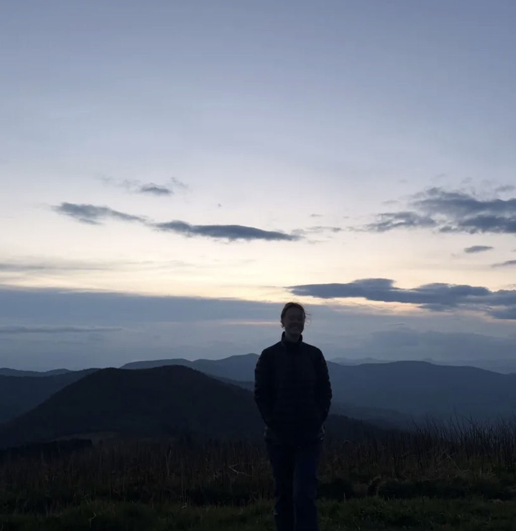
Primary guess
Max Patch, North Carolina
Confidence
• Level: High
• Why:
- The landscape features characteristic "balds" (treeless, grassy mountain tops) common in the Southern Appalachian Mountains, particularly along the Appalachian Trail.
- The rolling, layered mountain silhouettes in the background are iconic to the Blue Ridge Mountains region.
- Max Patch is widely famous for its 360-degree views, accessibility, and popularity for sunset photography, often resulting in images with identical compositions of a person silhouetted against the horizon.
- The vegetation—low, dormant-looking grasses—matches the high-altitude meadow environment of Max Patch.
Visual evidence
* **Mountain Silhouettes:** Multiple layers of receding, soft mountain ridges are characteristic of the Blue Ridge Mountains, specifically the views from high-elevation balds in Western North Carolina and Eastern Tennessee.
* **Foreground Vegetation:** The presence of tall, thin, dry grasses in the immediate foreground suggests a high-elevation alpine or sub-alpine "bald" environment, which is the defining feature of Max Patch.
* **Sunset/Golden Hour:** The soft, diffuse lighting and the silhouette of the person indicate a sunset or sunrise, common times for visitors to be at these scenic overlooks.
* **Apparel:** The person is wearing a puffer/down jacket, which is consistent with the cooler temperatures often found at high elevations (nearly 4,600 ft at Max Patch) even during warmer months.
Reasoning
The photo is a classic example of a mountain sunset silhouette, a very common genre of photography in the Appalachian Mountains. While many locations in the Blue Ridge Mountains (like Roan Mountain or Grayson Highlands) share similar topographies, Max Patch is the most recognizable "bald" associated with this specific type of wide-angle, panoramic sunset silhouette.
• **Roan Mountain:** While very similar, the balds at Roan Mountain are often characterized by more prominent rocky outcrops or distinct spruce-fir forests in the foreground.
• **Grayson Highlands:** Known for its wild ponies and large rock formations, the terrain in the photo lacks these specific distinctive markers.
• **Craggy Gardens:** Generally features a more forested approach to the viewing area and distinct rhododendron thickets, which are not clearly visible here.
Max Patch remains the most consistent match for the open, grassy, rolling terrain depicted in the image.
Verification
* Max Patch Hiking and Sunset Views
* Appalachian Trail Conservancy - Max Patch
* Blue Ridge Parkway Association - High Country Balds
Links
• Google Maps - Max Patch
• Max Patch Wikipedia
Coordinates
35°47'40.5"N 82°57'24.1"W