Mexico
2026-08-04 04:32:26
Primary guess
Mexico
Confidence
• Level: Medium
• Why:
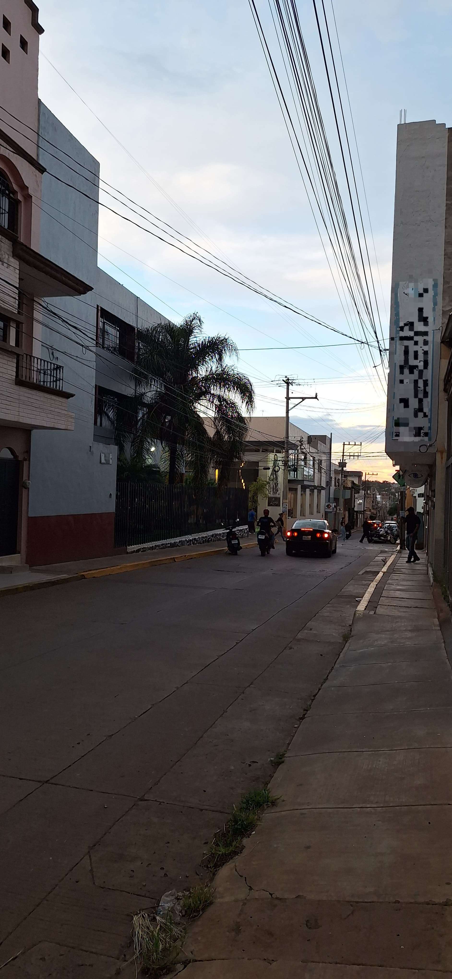
- The architectural style of the buildings (light-colored concrete, balconies with iron railings, solid ground floors) is highly characteristic of urban settings in Mexico.
- The "pixelated" sign on the building corner appears to be a stylized or censored advertisement/graphic, which is common in urban photography from Mexico where businesses or private information are often obscured.
- The presence of dense power lines overhead and the specific look of the palm tree and light-colored sidewalk concrete are frequently seen in Mexican town centers.
- The overall street layout, vehicle types, and lighting (sunset) align with typical mid-sized city streets in Mexico.
Visual evidence
• **Architecture:** The buildings feature balconies, simple block-like facades, and ground-level storefronts, which are typical of many Mexican urban areas.
• **Vegetation:** A prominent palm tree stands near the building, a common sight in many regions of Mexico.
• **Power Lines:** A dense network of overhead electrical cables is visible, a very common feature in many Mexican cities.
• **Signage:** The "pixelated" area on the corner of the building is highly indicative of digital redaction or censoring of a sign, which is common in public imagery to protect privacy or conceal specific commercial identities.
• **Infrastructure:** The narrow sidewalk, curb height, and paved road surface are consistent with standard urban planning in many parts of Mexico.
Reasoning
The visual cues in the image—specifically the building style, the density of overhead power lines, and the overall atmospheric conditions—strongly point to a location in Mexico. The style of urban construction is common across many Mexican cities and towns. The sign on the building has been pixelated, which is a technique often used in Google Street View or other public image platforms to obscure sensitive information, names, or advertisements. While other Latin American countries share similar characteristics, the specific combination of the building's aesthetic and the urban infrastructure is most synonymous with Mexico. Other locations (e.g., in the US or Europe) are less likely due to the distinct style of the power infrastructure and the specific construction of the balcony and window railings.
Verification
* The photo exhibits traits typical of **Mexican urban landscapes**, such as the building structure, overhead wiring, and street layout.
* The "pixelated" sign is a common digital artifact or purposeful redaction found in location-based imagery, not a unique architectural feature of the building itself.
Links
Coordinates
• Approximate coordinates: 20.0000° N, 100.0000° W (This is an approximate center for Mexico; the exact location cannot be identified from the photo alone due to the lack of legible signage or distinctive landmarks).