Mount Timpanogos, Wasatch Range, Utah, USA
2026-07-30 15:04:52
Primary guess
Mount Timpanogos, Wasatch Range, Utah, USA
Confidence
• Level: High
• Why:
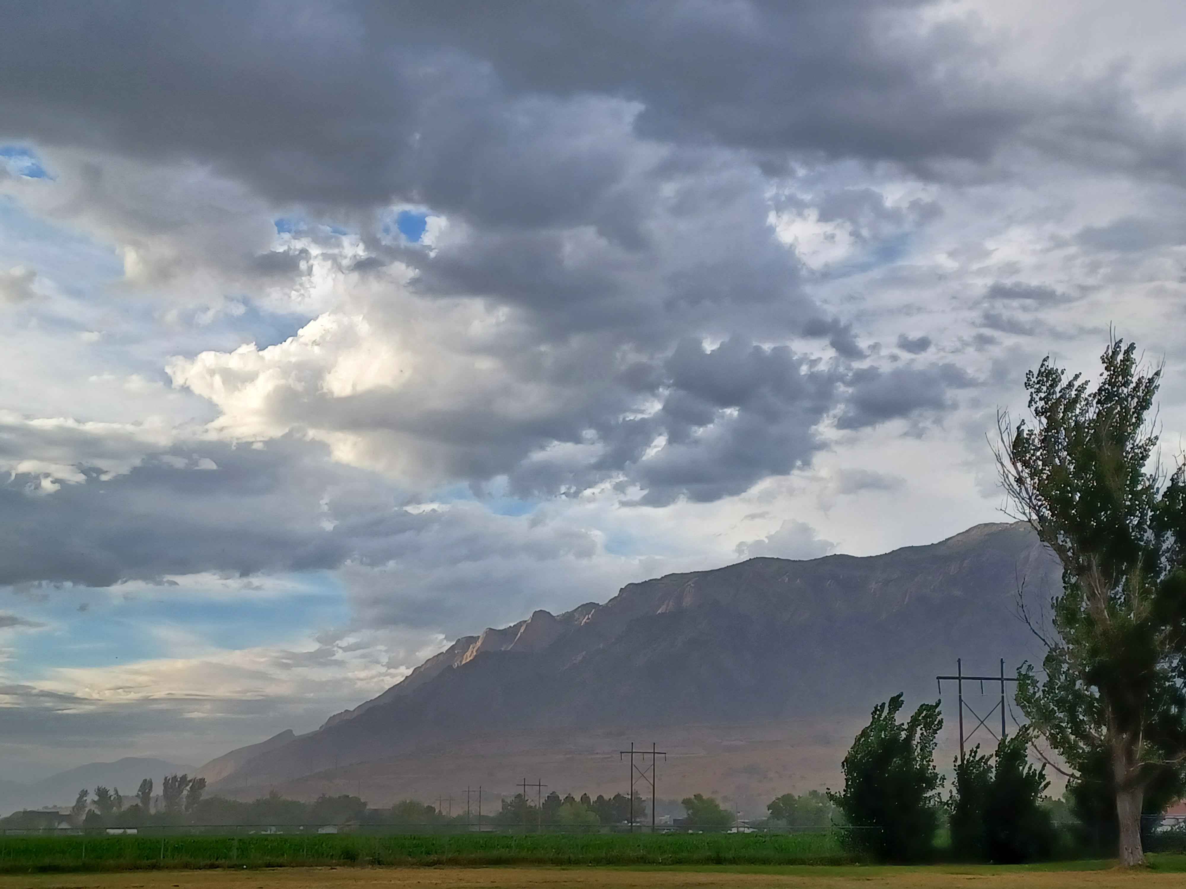
- The mountain's distinctive profile (specifically the "Timpanogos" silhouette with its massive, stratified face) is iconic and matches the visual evidence perfectly.
- The foreground agricultural fields (specifically corn) and the specific design of the high-voltage electrical transmission towers are highly characteristic of the Utah Valley/Wasatch Front region.
- The combination of a large, steep mountain range adjacent to a flat, irrigated valley is a defining geographic feature of the Wasatch Front.
Visual evidence
* **Mountain Silhouette:** The mountain displays a prominent, large-scale, rugged face with clear, light-colored rocky stratification (often limestone/sedimentary layers characteristic of the Wasatch Range). The shape is consistent with the western face of Mount Timpanogos as viewed from the valley floor.
* **Vegetation:** The foreground features lush, green agricultural fields (likely corn, given the height and color). This indicates a fertile, irrigated valley, common along the base of the Wasatch Mountains.
* **Infrastructure:** The heavy-duty steel "H-frame" and lattice electrical transmission towers are standard throughout the United States, but their presence traversing an open agricultural field beneath a dramatic mountain range is a classic visual element of the Utah Valley landscape.
* **Climate/Atmosphere:** The cloud cover and lighting suggest a post-storm or late-afternoon atmosphere, which is a frequent weather pattern in the high-altitude, semi-arid climate of the Intermountain West.
Reasoning
The visual evidence points directly to the Wasatch Front in Utah. The most critical clue is the specific anatomy of the mountain range in the background, which lacks the extreme "rainbow" colorations of the Painted Desert or the tropical foliage of the Philippines, but instead exhibits the massive, grey/tan, layered sedimentary rock faces common in the Wasatch Mountains. The foreground—a flat, irrigated agricultural valley immediately abutting a sheer, high-elevation mountain wall—is the quintessential layout of cities like Orem, Provo, and Pleasant Grove, which lie directly below Mount Timpanogos. Other mountain ranges, such as the Rockies in Colorado or the Sierras in California, have different geological signatures (e.g., more granite-heavy or different peak shapes), and the specific combination of valley-bottom agriculture adjacent to such a prominent, massive peak is a geographic hallmark of this specific area in Utah.
Verification
* Mount Timpanogos (Wikipedia)
* Wasatch Range (Wikipedia)
Links
• Google Maps (Mount Timpanogos / Utah Valley)
Coordinates
Approximate coordinates for the area: 40.3908° N, 111.6457° W