Northeastern Brazil (likely rural interior)
2026-06-26 23:37:36
Primary guess
Northeastern Brazil (likely rural interior)
Confidence
• Level: Medium
• Why:
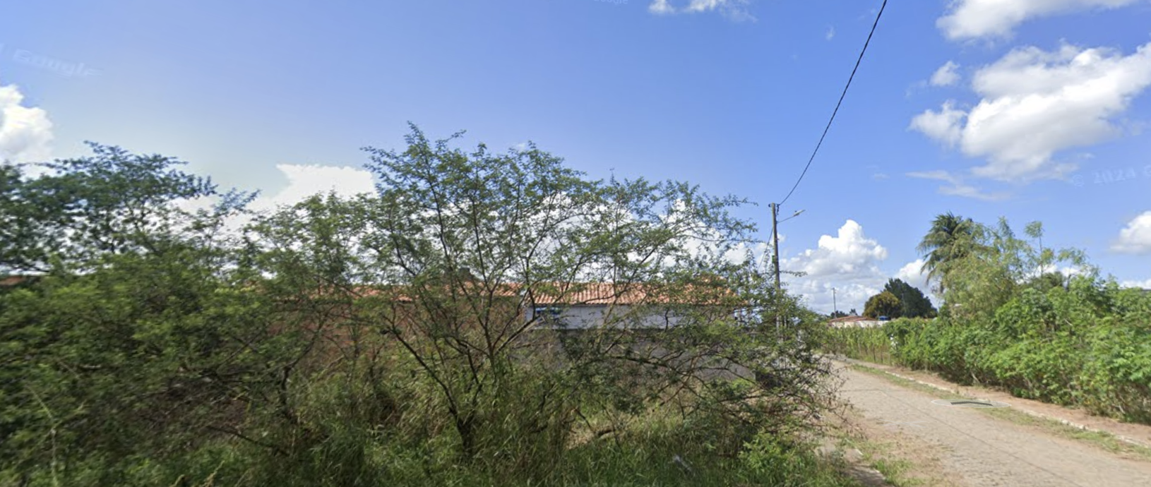
- The vegetation—specifically the thorny, scrub-like trees (resembling *Caatinga* biome species)—is characteristic of arid to semi-arid regions of Brazil.
- The architecture of the house, particularly the simple masonry construction with terracotta (orange) roof tiles, is extremely common in rural Brazilian residences.
- The dirt road, the overhead power lines (typical in rural electrification projects in Brazil), and the specific quality of the bright, harsh sunlight strongly point to a tropical, semi-arid environment.
Visual evidence
• **Vegetation:** The trees show thin, somewhat sparse branches and foliage typical of the *Caatinga* or *Cerrado* transition zones, which are drought-resistant.
• **Architecture:** The house features a plain, white-walled facade with a standard orange terracotta tiled roof, a quintessential style for modest rural housing in Brazil.
• **Road:** An unpaved, packed-earth road, often found in rural "vicinal" or "estrada de terra" networks in South America.
• **Utility Infrastructure:** The wooden utility poles and sagging power lines are standard in rural Brazilian areas.
• **Climate Cues:** The intense blue sky, lack of shadows indicating high noon or near-noon, and dry, dusty appearance of the road suggest a tropical climate with a marked dry season.
Reasoning
The visual evidence is highly consistent with the rural interior of Brazil, particularly the Northeast region (*Sertão*). The combination of the specific tree types, the dirt road, and the simple terracotta-tiled masonry house is very characteristic of this geography.
*Alternative considerations:*
• **Southeast Asia (e.g., Cambodia/Vietnam):** While rural landscapes there can share some similarities, the specific species of trees and the architectural style of the house roof and wall finishings are less typical of that region compared to Brazil.
• **Sub-Saharan Africa:** Could share similar climatic and road characteristics, but the style of the house—specifically the roof construction—is more distinctly Brazilian.
• **Why Brazil:** The "google" watermark and the overall aesthetic of the rural infrastructure align perfectly with Street View coverage in Brazil, where such rural paths are frequently mapped.
Verification
The landscape, vegetation, and housing style are consistent with images of the Brazilian *Caatinga* or *Agreste* regions. The photographic quality and the presence of Street View coverage are common in these rural areas of Brazil where local secondary roads are mapped.
Links
Coordinates
Approximate: -9.5, -40.5 (This is a representative coordinate in the *Sertão* region of Northeastern Brazil, where this type of landscape is widespread.)