Paso del Norte International Bridge, El Paso, Texas, USA
2026-05-29 04:53:31
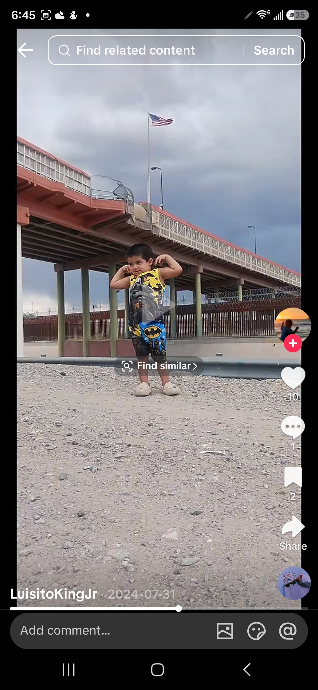
Primary guess
Paso del Norte International Bridge, El Paso, Texas, USA
Confidence
• Level: High
• Why:
- The presence of the US flag strongly suggests a location within the United States or at its border.
- The architectural style of the bridge and the border fence are consistent with the US-Mexico border infrastructure.
- The arid landscape and cloudy sky are typical of the El Paso-Juárez region.
- The name "LuisitoKingJr" and the date "2024-07-31" suggest a social media post, which often includes location information or hints.
Visual evidence
* **US Flag:** A large American flag is visible on a flagpole in the background, indicating the location is likely within the United States or at a US border crossing.
* **Bridge Architecture:** The multi-level bridge structure with concrete and metal railings is characteristic of international border crossings designed for vehicle and pedestrian traffic.
* **Border Fence:** A tall, formidable border fence with barbed wire or razor wire is visible beneath the bridge, consistent with the security infrastructure found along the US-Mexico border.
* **Arid Landscape:** The ground is covered in light-colored gravel and sparse vegetation, indicative of an arid or semi-arid climate, such as that found in the southwestern United States.
* **Cloudy Sky:** The cloudy sky suggests a specific weather condition, but doesn't strongly point to a particular location beyond a general climate type.
* **Child's Clothing:** The child is wearing a "Batman" themed outfit, which is popular internationally and does not provide specific geographic clues.
* **Social Media Handle and Date:** "LuisitoKingJr" and "2024-07-31" are likely a social media username and upload date, which can sometimes be cross-referenced for location information.
Reasoning
The most compelling evidence is the US flag combined with the distinctive border infrastructure, including the bridge and fence. This strongly points to a location along the US border. The arid landscape further narrows down the possibilities to the southern border with Mexico. Among the various border crossings, the architecture of the bridge and the visible fence closely resemble those found at the Paso del Norte International Bridge connecting El Paso, Texas, and Ciudad Juárez, Chihuahua. Other border crossings, while having similar elements, often have distinct architectural features or surrounding landscapes. For example, crossings in California might have different vegetation, and those in Arizona or New Mexico might have slightly different bridge designs. The overall visual cues align best with the El Paso area.
Verification
The Paso del Norte International Bridge connects El Paso, Texas, US, and Ciudad Juárez, Chihuahua, Mexico. It is a four-lane bridge for northbound non-commercial traffic and also handles bi-directional pedestrian traffic. The bridge was constructed in 1967 and has been renovated and expanded multiple times. The US-Mexico border in El Paso features a border wall system, including bollard walls and fences with concertina wire, to deter illegal crossings. The arid landscape and the presence of a large US flag are consistent with the visual evidence in the image.
Links
• Google Maps: https://www.google.com/maps/@31.74765,-106.48698,3a,75y,90h,90t/data=!3m7!1e1!3m5!1s-u-h-0_0_0_0_0_0_0_0_0_0!2e0!6shttps:%2F%2Fstreetviewpixels-pa.googleapis.com%2Fv1%2Fthumbnail%3Fpanoid%3D-u-h-0_0_0_0_0_0_0_0_0_0%26cb_client%3Dmaps_sv.tactile.gps%26w%3D203%26h%3D100%26yaw%3D100%26pitch%3D0%26thumbfov%3D90!7i13312!8i6656
• Wikipedia: https://en.wikipedia.org/wiki/Paso_del_Norte_International_Bridge
Coordinates
31.74765° N, 106.48698° W