Poznań, Droga Dębińska
2026-04-30 14:53:01
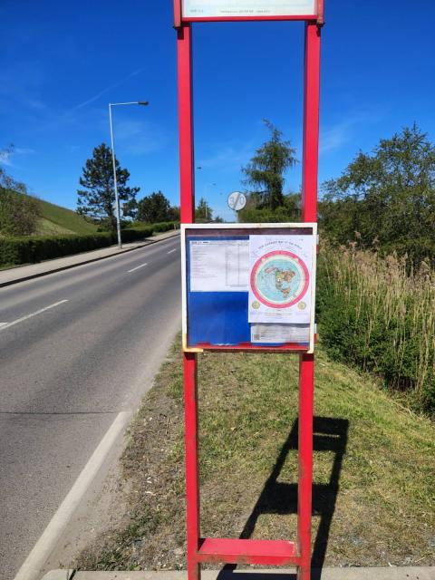
Primary guess
Poznań, Droga Dębińska
Confidence
• Level: Medium
• Why:
- The distinct red, dual-post structure with a top sign panel and middle timetable frame is a classic and iconic design used by ZTM Poznań for its bus stops.
- The blue square logo faintly visible in the top-left of the timetable is characteristic of standard ZTM Poznań printed schedules.
- The environment features a grassy embankment on the left, which strongly resembles the flood levees (wały przeciwpowodziowe) found alongside the Warta river in Poznań, specifically along roads like Droga Dębińska.
- The "End of 30 km/h zone" (Strefa 30) sign is common in Poznań's recreational or residential areas that transition into standard arterial roads.
- The combination of a wide, slightly curved road with a solid edge line, a levee on one side, and natural vegetation on the other is highly consistent with stretches of Droga Dębińska.
Visual evidence
• **Red metal signpost:** The specific dual-pillar red frame is older street furniture unique to the ZTM Poznań public transport network in Poland.
• **Timetable format:** The layout of the paper timetable, with a blue logo box in the top left, a left column for stops, and a right grid for times, is the standard ZTM Poznań template.
• **"End of 30" sign (B-43):