Punta Cana, La Altagracia Province, Dominican Republic
2026-04-28 14:26:58
Primary guess
Primary guess: Punta Cana, La Altagracia Province, Dominican Republic
Confidence
• Level: High
• Why:
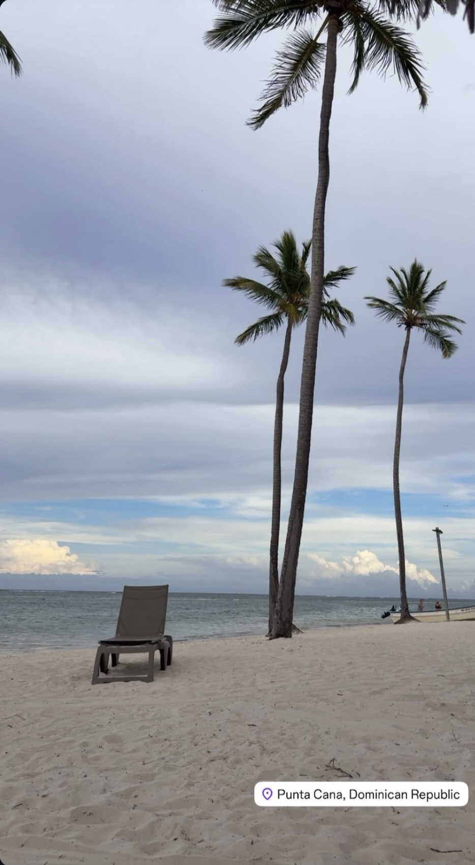
- The image features an explicit, unambiguous location overlay reading "Punta Cana, Dominican Republic".
- The visual elements (fine white sand, tall coconut palms, calm turquoise water) perfectly match the topography and climate of the "Coconut Coast" (Costa del Coco) in the eastern Dominican Republic.
- While the specific resort or stretch of beach cannot be pinpointed due to a lack of distinct architectural landmarks, the general region is confirmed by the overlay and supported by the visual context.
Visual evidence
• **Location Overlay:** A white pill-shaped sticker at the bottom right corner explicitly reads "Punta Cana, Dominican Republic" with a location pin icon.
• **Vegetation:** Tall, mature, slightly curving coconut palms (*Cocos nucifera*) dominate the foreground, heavily characteristic of the Caribbean coastline.
• **Geology/Terrain:** The beach features fine, pale (white/light tan) sand, which is a hallmark of the Punta Cana/Bávaro region.
• **Water Conditions:** The ocean is relatively calm with a visible color shift in the distance, suggesting a shallow sandy bottom or a protective barrier reef further out, typical of Playa Bávaro and surrounding beaches.
• **Objects:** A single, dark grey, heavy-duty plastic resort sun lounger sits on the sand, indicating a tourist-oriented or resort beach.
• **Background Details:** A small motorized skiff/boat with an outboard motor and a couple of people is visible near the shoreline in the background, common for local excursions, fishing, or resort transport. A single pole, possibly a light or flag pole, stands near the water's edge on the right.
Reasoning
The primary and overriding piece of evidence for this location is the social media location tag directly applied to the image, which states "Punta Cana, Dominican Republic".
As an analyst, the next step is to verify if the visual evidence supports or contradicts this tag. The visual clues are highly consistent with the eastern coast of the Dominican Republic. The region is famous for its long stretches of continuous white sand beaches heavily lined with tall palm trees (giving it the nickname *La Costa del Coco*). The calm water profile suggests a reef-protected shore, which stretches for miles along the Bávaro and Punta Cana coastline.
Because the landscape is relatively uniform and lacks unique, identifiable structures (like a specific pier, uniquely shaped island, or distinct hotel architecture), it is impossible to narrow down the exact resort or kilometer of beach. The location could be anywhere along Playa Bávaro, Playa Arena Gorda, Cabeza de Toro, or Cap Cana. Therefore, the most accurate and intellectually honest identification is the broader Punta Cana region as indicated by the tag.
Alternative locations like other Caribbean islands, the Maldives, or Southeast Asia might have similar generic tropical features, but there is no contradictory evidence to suggest the geotag is false or spoofed.
Verification
No advanced verification via Google Search is necessary to confirm the location beyond the provided overlay, as the visual features are universally recognized characteristics of the tagged region.
Links
• Google Maps - Punta Cana
• Wikipedia - Punta Cana
Coordinates
18.6825, -68.3975 (Approximate center of the Punta Cana/Bávaro beach coastline. Exact coordinates cannot be determined without distinctive landmarks.)