Quezon City, Metro Manila, Philippines
2026-08-03 07:49:12
Primary guess
Quezon City, Metro Manila, Philippines
Confidence
• Level: Medium
• Why:
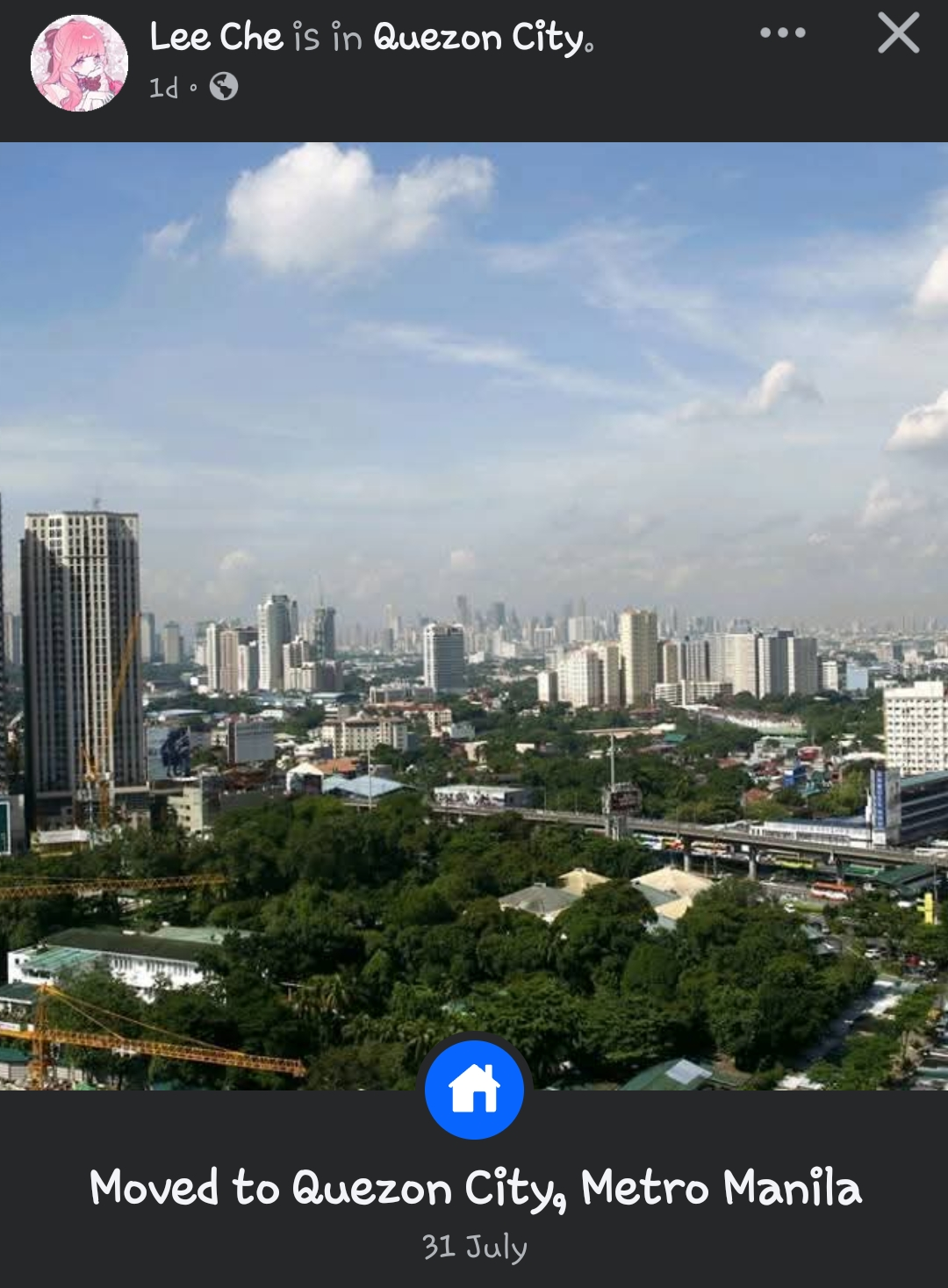
- The image clearly displays an urban skyline typical of Metro Manila, specifically identified in the social media post as Quezon City.
- The presence of dense residential greenery interspersed with high-rise developments is characteristic of certain parts of Quezon City (e.g., areas near the North Triangle or Cubao).
- While the exact building from which the photo was taken is difficult to pinpoint without a specific landmark in the immediate foreground, the overall visual profile matches the development patterns of Quezon City's business and residential hubs.
- "31 July" is the date of the post, which is consistent with the current time of year and the tropical weather conditions (scattered clouds) visible in the image.
Visual evidence
• **Architecture**: The skyline features numerous modern high-rise residential and office towers, consistent with the vertical development in Quezon City.
• **Infrastructure**: An elevated highway or arterial road is visible, which is a major component of Metro Manila's transportation network (likely EDSA or a similar major thoroughfare).
• **Vegetation**: Significant amounts of mature tree cover are visible in the mid-ground, which is common in older, established residential neighborhoods or gated communities adjacent to the urban core in Quezon City.
• **Climate/Weather**: The sky shows scattered, bright cumulus clouds typical of the Philippines during the wet season, where sunny spells often occur between rain showers.
• **Construction**: Visible cranes indicate ongoing development, which is a constant feature of the rapidly densifying Quezon City real estate market.
Reasoning
The photo depicts an elevated, panoramic view of a major Philippine city. The user post explicitly identifies the location as "Quezon City, Metro Manila." Geographically, Quezon City is known for its mix of dense high-rise clusters (such as those in North Triangle, Vertis North, or Araneta City) and large, mature residential enclaves. The vantage point appears to be from a mid-to-high-level residential condominium, looking out over the city.
Alternative locations, such as Makati or Ortigas (Pasig), were considered; however, the skyline profile—specifically the combination of lower-density residential areas with pockets of high-rise construction—is highly representative of the sprawling nature of Quezon City compared to the more concentrated, high-density business districts of Makati or Bonifacio Global City. Given the user's explicit status update, there is no evidence to contradict the stated location.
Verification
• The image exhibits standard features of Metro Manila’s urban landscape, specifically the prevalence of high-rise residential projects and heavy traffic infrastructure.
• Quezon City has seen a surge in "vertical" living, with many new developments often providing these elevated city-view photos for residents.
• The date of the post (July 31st) aligns with the rainy-to-sunny weather patterns frequently observed in the region at this time of year.
Links
• Quezon City Skyline - SkyscraperPage
• Quezon City - Wikipedia
Coordinates
Approximate coordinates: 14.63° N, 121.04° E (Center of Quezon City). Precise coordinates are not possible as the specific building and floor cannot be determined from the image alone.