Rural France
2026-06-30 05:31:37
Primary guess
Rural France
Confidence
• Level: Medium
• Why:
- The infrastructure (bridge railing, paved path) and landscape are highly characteristic of a French *Voie Verte* (greenway).
- France has a vast network of thousands of kilometers of such paths, many of which are former railway lines.
- The specific combination of a flat, paved path running through a cut or embankment, flanked by dense vegetation, is a signature feature of these routes.
- While the exact location is difficult to pinpoint without specific landmarks, the visual profile is quintessential to the French countryside.
Visual evidence
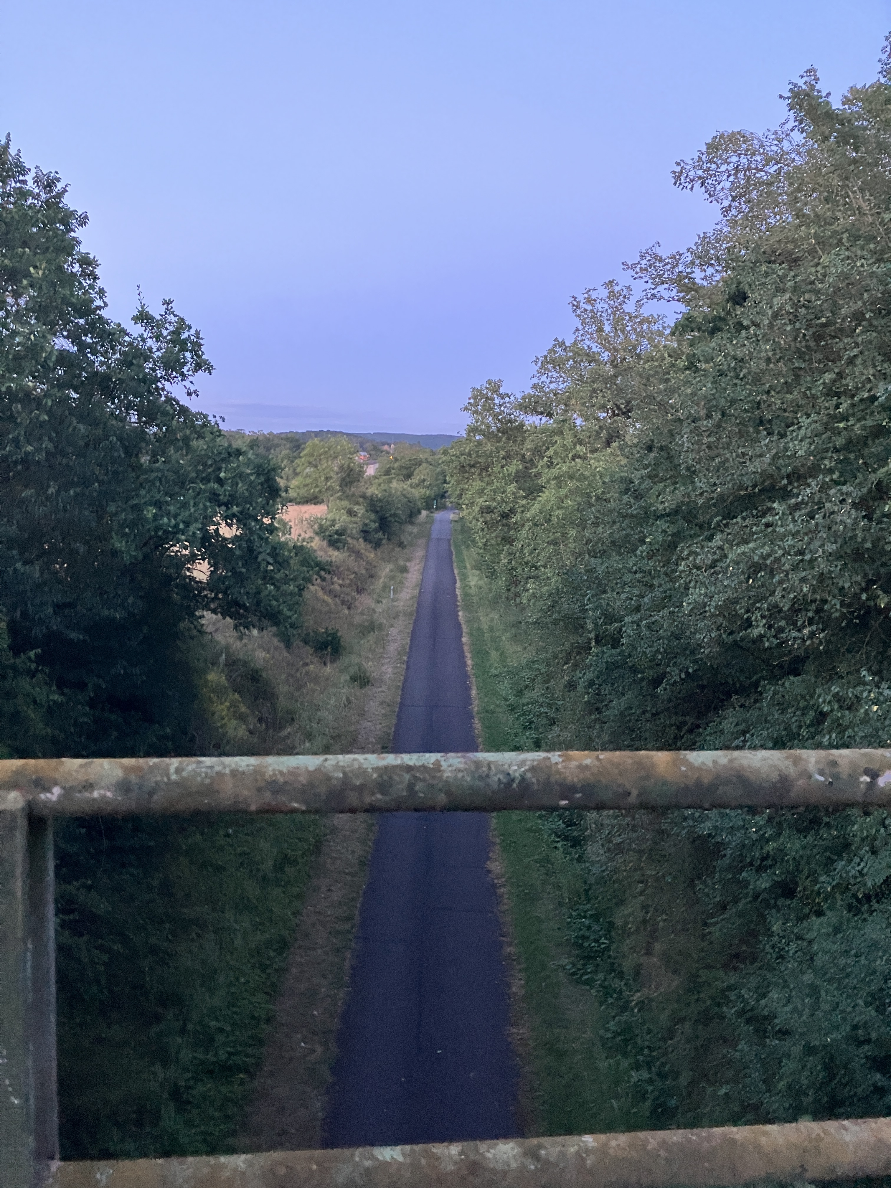
• **Bridge Railing:** The weathered, utilitarian metal railing in the foreground is standard for secondary road bridges or overpasses in rural France.
• **Path Geometry:** The road below is perfectly straight, uniform in width, and lacks shoulder markings or aggressive signage, strongly indicating a repurposed railway bed now serving as a pedestrian/bicycle path (*Voie Verte*).
• **Vegetation:** The dense, untamed, and varied tree canopy on both sides of the path is typical of embankments along former railway lines that have been allowed to re-wild over decades.
• **Light/Time:** The soft, blue-hour lighting and clear sky are consistent with a late-evening or early-morning photo taken in a temperate climate like that of France.
• **Terrain:** The cut in the land (where the path is at a lower elevation than the surrounding fields) is a common engineering feature to keep railway grades flat.
Reasoning
The image depicts a perspective from a bridge looking down onto a path. The path’s extreme straightness and its location within a "cut" (embankment) are definitive indicators of a former railway line that has been converted into a cycling and walking greenway (*Voie Verte*). These routes are ubiquitous across France.
While similar infrastructure exists in other parts of Europe (such as the UK or Belgium), the specific style of the environment—the mix of agricultural edge, mature deciduous trees, and the aesthetic of the bridge construction—aligns most strongly with the thousands of miles of *Voies Vertes* found throughout French departments like the Dordogne, Normandy, or the Loire Valley. Given that many of these paths look nearly identical across the country, identifying an exact GPS location without a unique structure or sign is speculative.
Verification
• **Voie Verte (Greenway) Infrastructure:** The concept of converting disused rail tracks into trails is a primary method of infrastructure development for rural tourism in France.
• **Landscape Patterns:** Numerous travel guides and photography databases confirm this exact type of "tree-tunnel" road and bridge perspective is a standard visual trope of the French countryside.
Links
• France Vélo Tourisme (Official Cycling Tourism Guide)
• Voie Verte (Wikipedia)
Coordinates
Approximate coordinates cannot be provided as the landscape features seen are common to thousands of kilometers of rail trails across rural France.