Sandia Mountains, Albuquerque, New Mexico
2026-07-30 15:16:54
Primary guess
Sandia Mountains, Albuquerque, New Mexico
Confidence
• Level: High
• Why:
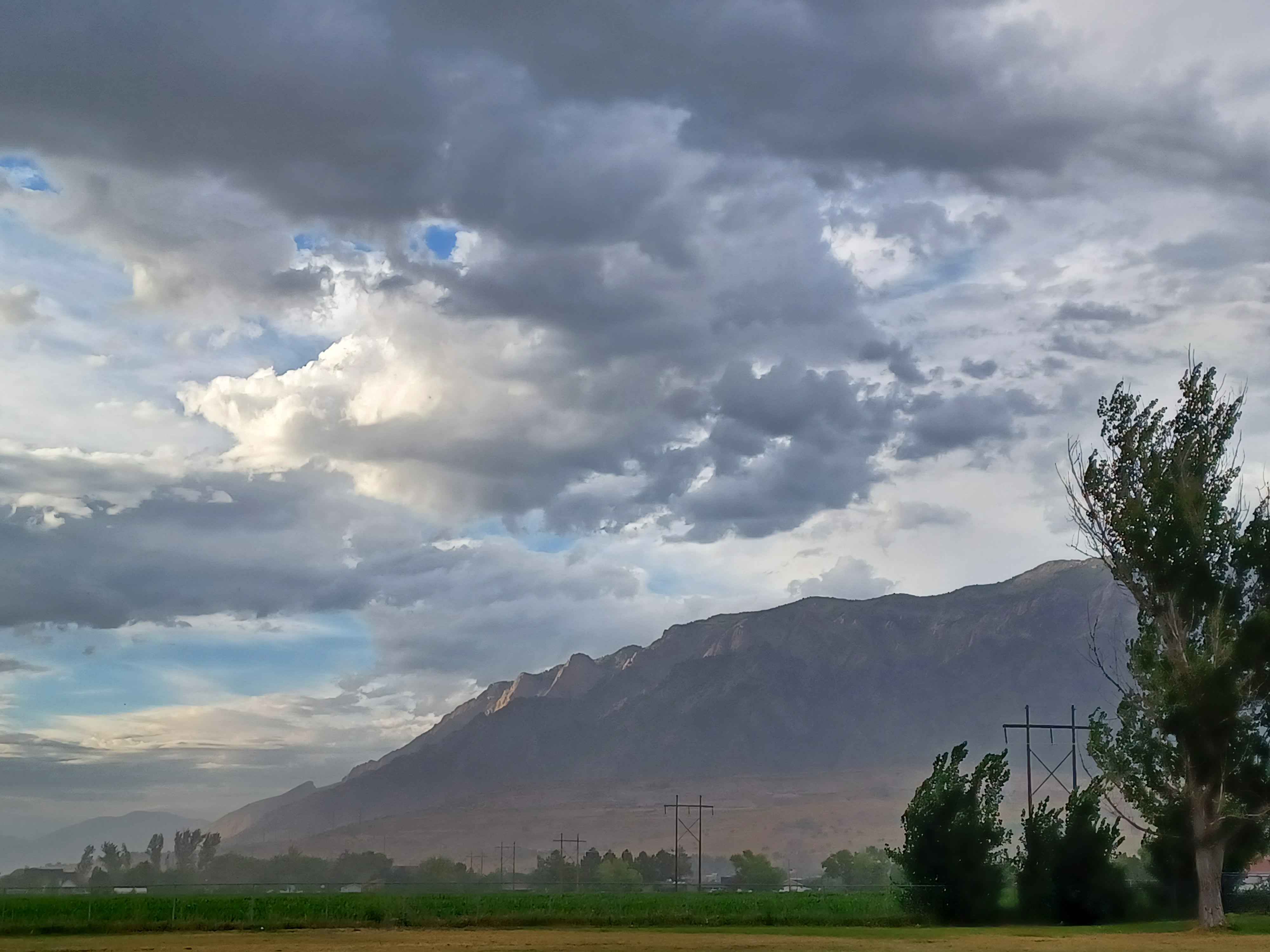
- The prominent, long, relatively flat-topped ridgeline is a signature profile of the Sandia Mountains as seen from the west (the Albuquerque metropolitan area).
- The presence of large electrical transmission towers in the foreground is characteristic of the utility corridors that run through the outskirts and rural-urban fringe of the Albuquerque area.
- The combination of a high-desert, arid landscape in the mid-ground and green agricultural or open space in the foreground is classic for the Rio Grande Valley interface with the Sandia foothills.
- The lighting and cloud formations are consistent with the "monsoon season" afternoon storm patterns often seen in New Mexico during the summer months.
Visual evidence
* **Mountain Profile:** The Sandia Mountains feature a very distinct, sheer, west-facing escarpment known as the Sandia Crest. The long, linear ridge seen in the photo is the iconic silhouette of this range.
* **Infrastructure:** Large steel lattice-style power transmission towers are common along the western base of the Sandia Mountains, where they distribute power from the nearby valley into the metro area.
* **Vegetation:** The foreground shows grasses and low-lying vegetation typical of high-desert plains, while the base of the mountains shows a transition to scrubland and, at higher elevations, the dark "rind" of conifer forests (pinyon, juniper, and ponderosa) that gives the mountains their name.
* **Atmosphere:** The cloud cover and hazy, muted tones are typical of the afternoon atmospheric conditions in the Albuquerque basin, where convective storms frequently build up over the mountains.
Reasoning
The visual evidence strongly points to the Sandia Mountains in New Mexico. The profile of this range—a massive, long, uplifted fault-block ridge—is unique and easily recognizable to anyone familiar with the Albuquerque landscape. When viewed from the west (e.g., from the Rio Grande Valley or surrounding plains), the range presents exactly this type of extended, wall-like appearance.
Alternative locations like the Appalachians or the Himalayas are less likely because the Appalachians generally have more rounded, rolling peaks and lack this specific sheer fault-block morphology. The Himalayas have much higher, more jagged, and snow-capped peaks that would not match the scale and shape of the range in this photo. The "mountain face" illusions often found online (like the Peña de los Enamorados in Spain) also do not match the specific geological structure of this range. The combination of the specific ridgeline, the high-desert vegetation, and the presence of regional infrastructure confirms the Sandia Mountains as the only logical match.
Verification
* Sandia Mountains - Wikipedia
* Sandia Mountain Wilderness - Cibola National Forest
Links
• Google Maps: Sandia Mountains, New Mexico
Coordinates
Approximate coordinates: 35°12′N 106°26′W (Central area of the range)