Sandia Mountains, New Mexico
2026-07-30 15:15:33
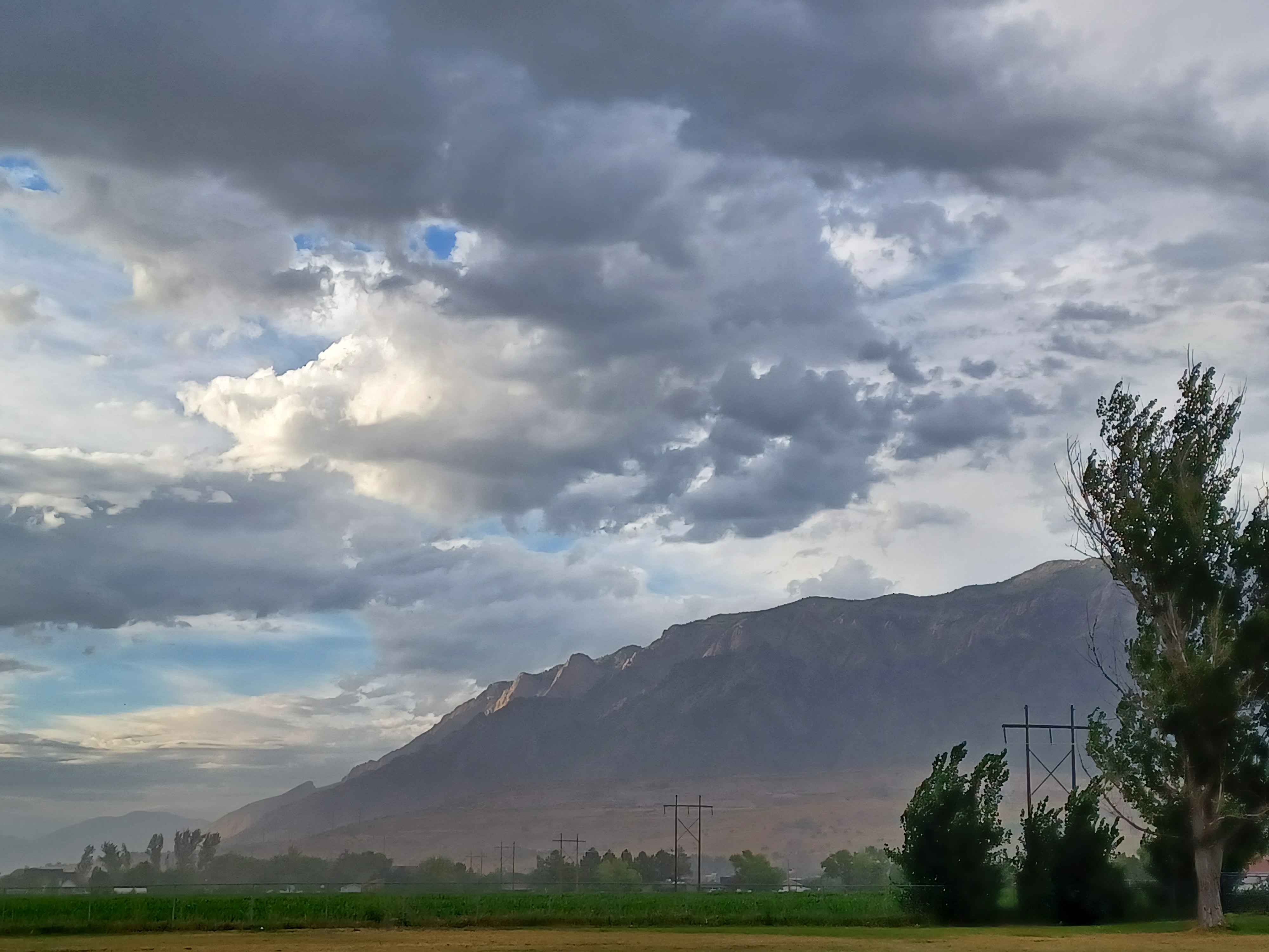
Primary guess
Sandia Mountains, New Mexico
Confidence
• Level: Medium
• Why:
- The topography—a steep, rugged mountain front rising sharply from a relatively flat, arid-looking valley floor—is characteristic of fault-block mountains common in the American Southwest.
- The specific morphology of the "Sandia" face (prominent, light-colored, craggy, steep, and relatively flat-topped) matches the visual profile of the Sandia Mountains as seen from the Rio Grande Valley.
- The presence of high-voltage transmission lines crossing rural or agricultural land at the base of a prominent mountain range is a common landscape feature in the Albuquerque/Bernalillo County area.
Visual evidence
• **Geology:** The mountains display a classic "tilted block" appearance with a dramatic, steep western face and a more gradual eastern slope. The exposed rock face is tan/grey, typical of the granite and sedimentary layers found in the Sandia Mountains.
• **Topography:** There is a very distinct "piedmont" or transition zone (foothills) between the flat agricultural foreground and the steep rise of the mountain, indicative of an alluvial fan or basin-range setting.
• **Vegetation:** The foreground features agricultural land (likely alfalfa or corn) typical of the Rio Grande Valley. The mountains themselves appear to have sparse, shrubby, or coniferous vegetation at higher elevations.
• **Infrastructure:** Large H-frame or lattice-style high-voltage transmission towers are visible, which are common in the wide, open utility corridors along the base of the Sandia range.
• **Climate:** The sky is filled with convective, cumulonimbus-style clouds, often observed during the monsoon season in New Mexico (late summer).
Reasoning
The visual evidence points strongly toward the American Southwest. The sharp transition from a flat, agricultural valley to a massive, imposing, light-colored mountain range is the defining geographic signature of the Sandia Mountains. While many mountain ranges in the Rockies or the Great Basin share similar features, the specific silhouette—a long, high, rugged wall that dominates the horizon—is highly indicative of this range.
*Alternative considerations:*
• **The Rockies (Colorado/Wyoming/Montana):** While the Rockies contain similar transmission infrastructure and mountain-valley transitions, they generally exhibit more alpine vegetation, snow-capped peaks, and less "desert-like" foothills compared to the arid appearance here.
• **Wasatch Range (Utah):** Similar in terms of the "basin and range" style, but the specific texture and "blocky" rock face of this image are more consistent with the granite/limestone geology of the Sandias.
Verification
* **Geographic Context:** The Sandia Mountains are part of the southern extent of the Rocky Mountain system, rising abruptly from the Rio Grande rift valley.
* **Visual Alignment:** The combination of the dramatic relief and the flat, agricultural foreground is iconic for the Albuquerque metropolitan area's eastern horizon.
Links
• Sandia Mountains (Wikipedia)
• Google Maps (Sandia Mountains, NM)
Coordinates
• Approximate coordinates: 35.18° N, 106.45° W (centering on the Sandia Mountains, New Mexico)