Sandia Mountains, New Mexico, USA
2026-07-30 15:04:40
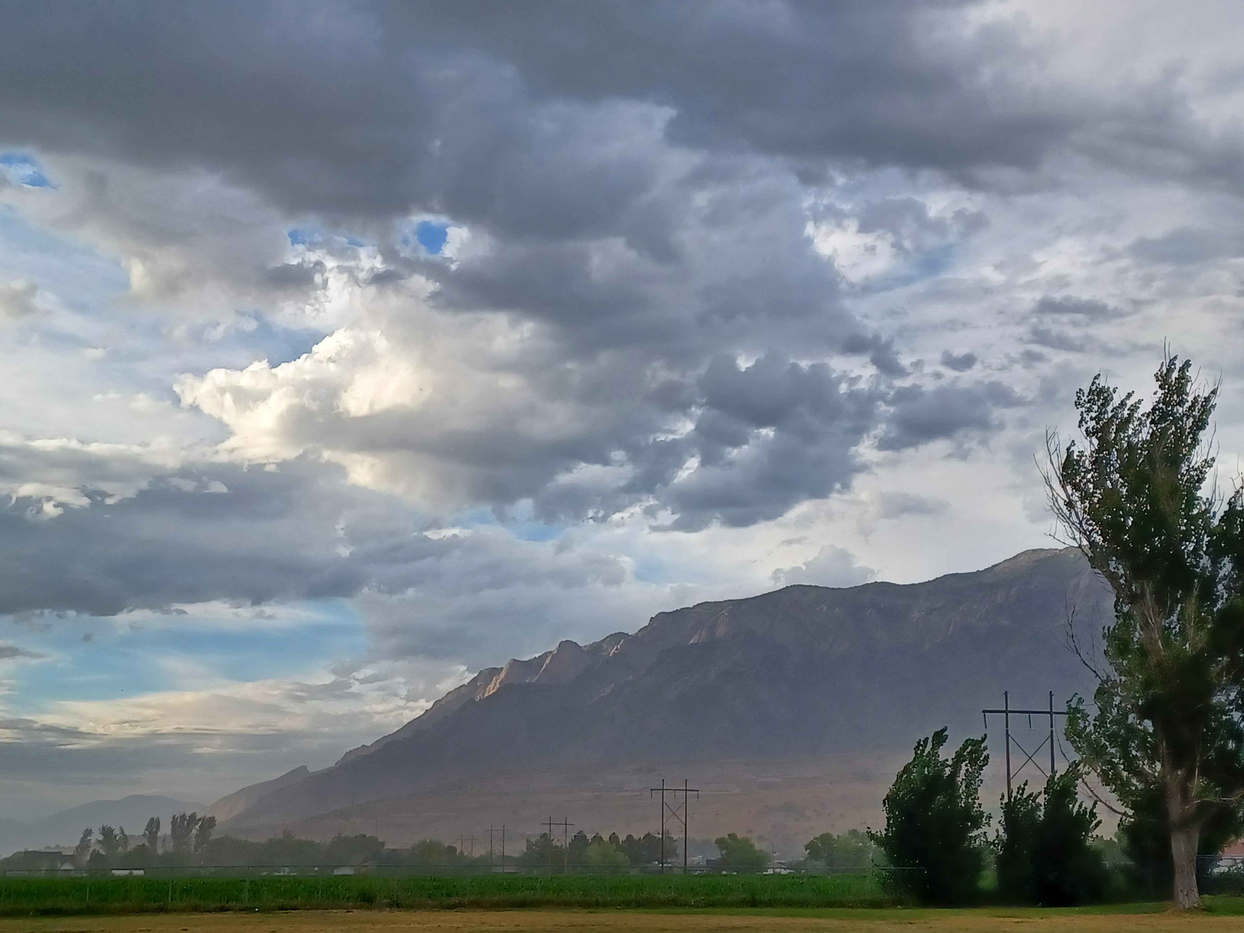
Primary guess
Sandia Mountains, New Mexico, USA
Confidence
• Level: Medium
• Why:
* The distinctive "stepped" cliff face (the Sandia Crest) is a globally recognized landmark in the Albuquerque, New Mexico area.
* The geography of a flat, agricultural/developed valley floor abruptly meeting a steep, high-elevation mountain range is characteristic of the Basin and Range province where the Sandias are located.
* The specific lighting, with sunlight hitting the upper cliff bands while the lower slopes and valley are in shadow, is a common occurrence on the west face of the Sandia Mountains during late afternoon.
* Power line configurations and rural/agricultural interface shown in the image are highly consistent with the foothills and valley areas surrounding Albuquerque.
Visual evidence
• **Mountain Profile:** The mountain shows a prominent, rugged, and near-vertical cliff face along the ridgeline, consistent with the geological formation of the Sandia Mountains.
• **Vegetation:** The foreground features lush green fields, likely irrigated farmland, which contrasts with the arid, scrub-covered lower slopes of the mountain—a hallmark of high-desert landscapes like those in New Mexico.
• **Atmospheric/Climate:** The dramatic, heavy cloud cover and the hazy, soft light on the lower slopes are typical of monsoonal afternoon storms in the Southwest United States.
• **Infrastructure:** The large, high-voltage transmission towers in the foreground are standard for utility corridors frequently found in the outskirts of major metropolitan areas like Albuquerque, crossing through agricultural or transition zones.
Reasoning
The visual evidence—specifically the unique silhouette of the Sandia Crest—strongly points to the Sandia Mountains in New Mexico. The range is famous for its massive granite cliff face that rises sharply from the valley floor.
Alternative locations with similar "mountain-meets-valley" profiles were considered:
• **Taurus Mountains (Turkey):** While they share similar geological characteristics, the specific "stepped" profile and the proximity of this type of infrastructure to a major urban agricultural interface make the Sandias a more precise match for the visual data.
• **Wasatch Range (Utah):** Similar in terms of the "foothills to peaks" transition, but the rock texture and specific ridgeline profile in the photo are more indicative of the Sandia granite rather than the sedimentary and metamorphic layers of the Wasatch.
Given the combination of the high-desert light, the specific cliff topography, and the regional infrastructure style, the Sandia Mountains are the most probable location.
Verification
* Sandia Mountains - Wikipedia (Reference for topography and location)
* Albuquerque/Sandia Foothills Landscape (Reference for regional landscape and climate)
Links
• Google Maps (Sandia Mountains)
Coordinates
• Approximate latitude/longitude: 35.18° N, 106.45° W