South Florida canal system
2026-08-11 12:28:38
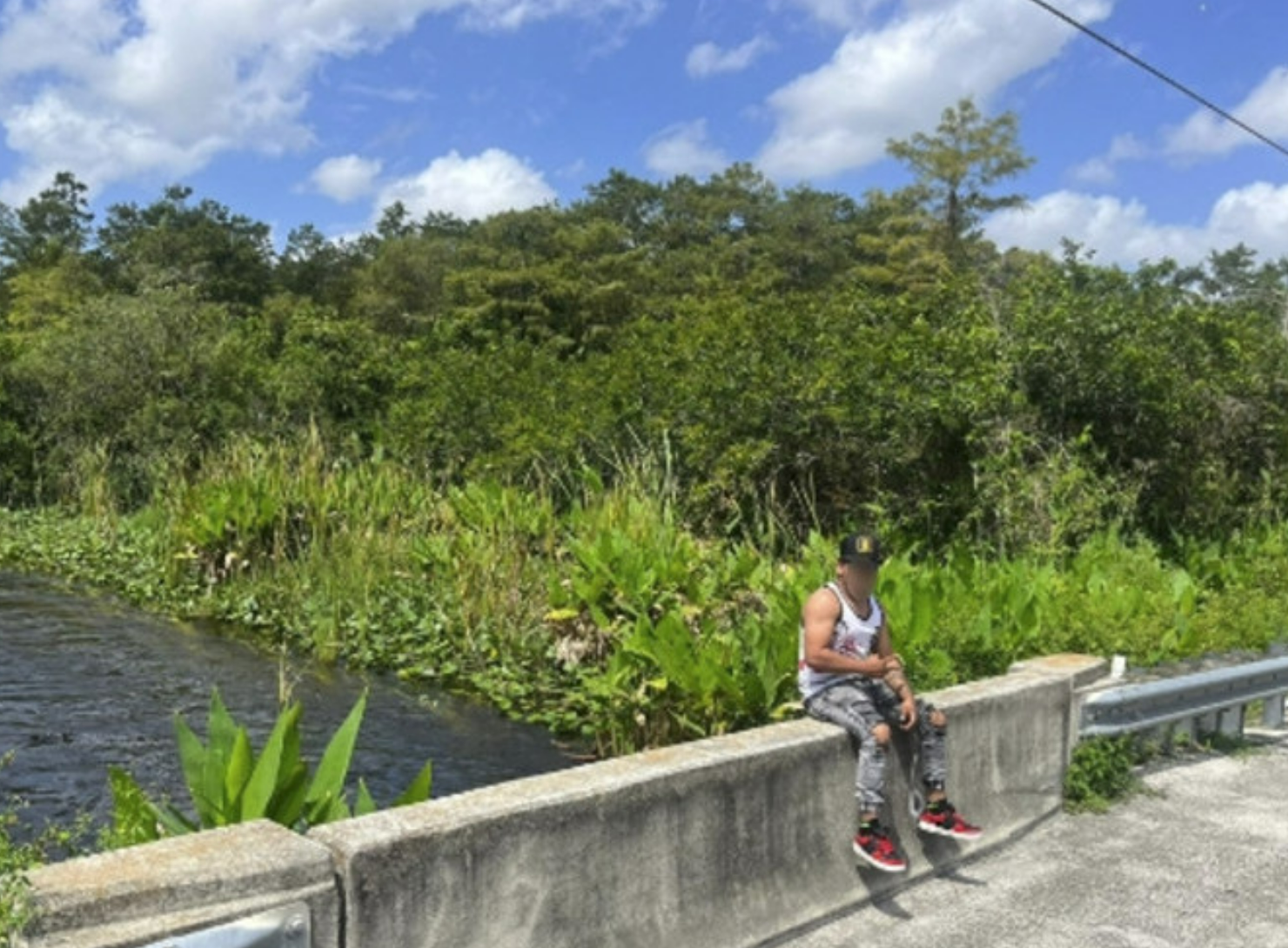
Primary guess
South Florida canal system
Confidence
• Level: Medium
• Why:
- The structural design of the concrete bridge railing and canal wall is characteristic of South Florida's extensive water management and flood control infrastructure.
- The vegetation—specifically the lush, green aquatic plants growing along the water's edge and the surrounding dense, subtropical/tropical forest—is highly indicative of the South Florida landscape.
- The presence of a paved road with a modern metal guardrail adjacent to a managed canal is a ubiquitous feature in suburban and rural South Florida areas (e.g., near the Everglades or in residential areas built on reclaimed wetlands).
- While precise geolocation of such a generic canal segment is difficult without unique identifying markers (like bridge numbers or local road signs), the visual environment matches thousands of miles of similar canals maintained by agencies like the South Florida Water Management District.
Visual evidence
* **Concrete Bridge/Canal Railing:** The low-profile, utilitarian concrete barrier is a standard design used for bridge edges and canal embankments in Florida to manage water and provide safety.
* **Aquatic Vegetation:** The lush green vegetation growing at the water's edge (emergent aquatic plants) is typical of Florida's freshwater canal systems, which require frequent management to prevent clogging.
* **Subtropical Forest:** The background consists of dense, mixed hardwood and shrubby vegetation, characteristic of the unmanaged or semi-managed natural areas bordering canals in Florida.
* **Infrastructure:** The presence of a metal guardrail (right side) and a paved surface indicates a road running parallel to the canal, which is typical for maintenance access roads or residential perimeter roads in Florida.
* **Climate/Lighting:** The high-angle, bright, direct sunlight and the high, wispy clouds suggest a warm, humid, tropical or subtropical climate, consistent with Florida's weather patterns.
Reasoning
The photo displays the hallmarks of South Florida's water management landscape. Florida relies on an immense network of thousands of miles of canals for flood control and drainage, particularly in the southern half of the state. The specific combination of a concrete-walled canal, a paved road with standard highway-style metal guardrails, and the dense, lush, subtropical vegetation is diagnostic of this region.
While similar canals exist in other tropical or subtropical climates, the specific aesthetic of the concrete construction—often seen in projects managed by the South Florida Water Management District—points strongly to Florida. Alternative locations, such as parts of Louisiana or the Caribbean, share similar vegetation, but the specific engineering style of the concrete curb and bridge railing is most commonly associated with Florida's urban/suburban-fringe development. Without unique signage, a specific bridge number, or distant landmarks, this is a generic but highly identifiable type of location within the South Florida interior.
Verification
* University of Florida IFAS: Canals in Florida - Describes the commonality of residential and regional canals in South Florida used for drainage and flood control.
* South Florida Water Management District - Manages the regional canal systems that feature these types of concrete water control structures and maintenance access roads.
Links
• South Florida Water Management District Canal Map (Reference for canal infrastructure)
Coordinates
Approximate location: 26.0000° N, 80.5000° W (Generic representation of the South Florida canal region; specific coordinates cannot be determined from the image alone).