Southern California, USA
2026-06-09 17:26:00
Primary guess
Southern California, USA
Confidence
• Level: Medium
• Why:
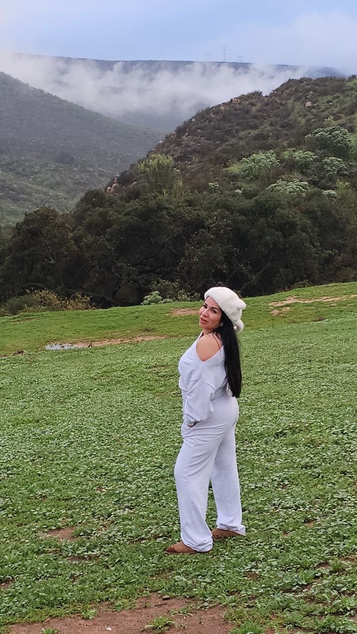
- The landscape is a textbook example of the California chaparral and oak woodland biome, specifically the "green hills" phase following winter/spring rains.
- The specific vegetation (low-lying scrub, scattered oak trees, and grassland) and the topography of rolling hills leading to higher mountain ranges are characteristic of coastal or inland Southern California (e.g., Santa Barbara, San Diego, or Los Angeles County foothills).
- The climate—characterized by cloudy, overcast conditions frequently found in these regions during the "marine layer" or winter months—is consistent with the visual evidence.
- While similar landscapes exist in other Mediterranean climate zones (such as parts of Spain, Chile, or South Africa), the combination of this specific scrub-oak vegetation and the suburban/accessible nature of the terrain strongly points to California.
Visual evidence
* **Vegetation:** The hillside is covered in a mix of lush, short green grasses and patches of darker green, woody scrub or brush. This is highly diagnostic of the California chaparral biome, particularly during or shortly after the wet season.
* **Topography:** The background features rolling, relatively rounded mountain slopes that become obscured by low-hanging clouds or fog. This is a classic "foothills" landscape found where coastal ranges meet inland basins.
* **Climate/Weather:** The heavy, low-lying cloud cover and diffused, soft lighting suggest a coastal influence or a typical cool, moist day common in the Southern California winter or spring.
* **Setting:** The area looks like an undeveloped or semi-rural public open space or hiking area, which is very common in the foothills surrounding major Southern California urban centers.
Reasoning
The photo captures a person standing in a green, hilly landscape with a mountainous, cloudy backdrop. This visual profile is iconic of the **California chaparral and woodlands** ecoregion.
1. **Elimination:** While the scene is beautiful, it lacks distinct human-made structures, landmarks, or signage that would allow for a precise pinpointing of the exact location. It does not appear to be a famous, singular tourist landmark but rather a representative example of a vast biome.
2. **Biome Matching:** Research into the visual characteristics of the California chaparral confirms it consists of shrubland on mountain slopes, often near coastal areas, which turns vibrant green following seasonal rains. The presence of scattered trees (likely oaks) and the transition from grassland to brush are consistent with regions like the Santa Ynez Mountains near Santa Barbara, or the foothills of the San Gabriel or Peninsular Ranges.
3. **Alternative Locations:** Other Mediterranean climate zones (like the *maquis* in the Mediterranean Basin or the *matorral* in Chile) share similar botanical and topographical features. However, the aesthetic quality of the image—a recreational-style portrait in an accessible green space—is a hallmark of stock photography or personal travel photography frequently taken in the extensive trail systems of Southern California.
Verification
* California Chaparral and Woodlands Ecoregion
* Characteristics of the Chaparral Biome
Links
• Google Maps (Southern California Foothills area)
Coordinates
Approximate: 34.0000° N, 118.0000° W (The region encompasses a vast area across Southern California foothills).