St. Peterzell, Neckertal, Switzerland
2026-07-03 19:44:09
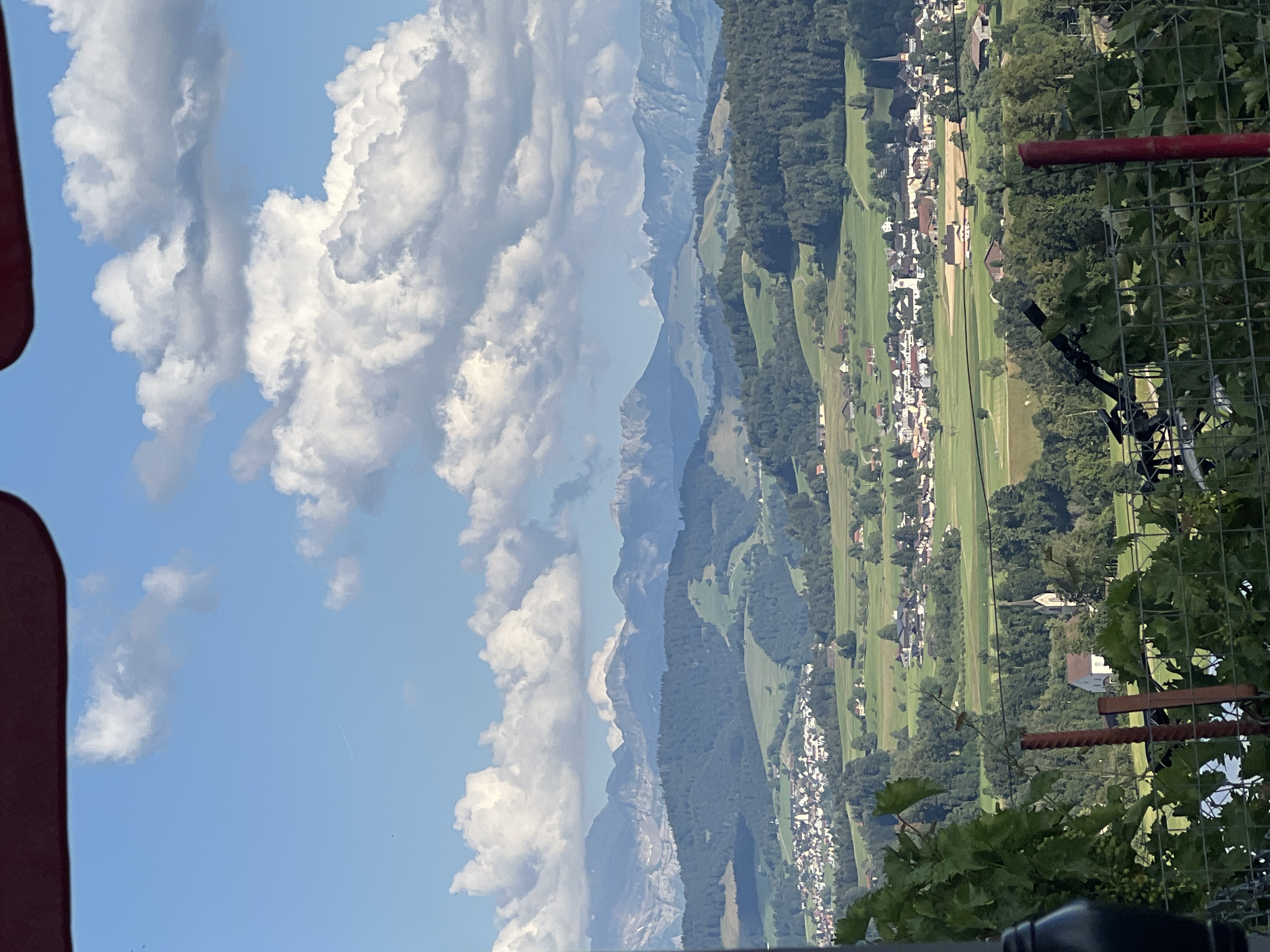
Primary guess
St. Peterzell, Neckertal, Switzerland
Confidence
• Level: High
• Why:
- Multiple visual clues align perfectly with the geography of St. Peterzell, including its iconic monastery church spire and the surrounding Toggenburg landscape.
- The geographical context, specifically the location in the Neckertal valley with views towards the Appenzell/Alpstein mountain range (dominated by Säntis), is well-documented in travel guides and hiking trails for this specific village.
- The village's architectural style—gabled Toggenburg houses—is a distinctive feature mentioned in records of the region.
Visual evidence
• **Church Spire:** The prominent church spire in the foreground is characteristic of the former monastery church (Propsteikirche) of St. Peterzell.
• **Topography:** The landscape features the classic "gentle rolling" hills of the Appenzellerland and Toggenburg regions, which contrast with the dramatic, jagged limestone peaks of the Säntis/Alpstein massif seen in the background.
• **Vegetation:** The foreground shows lush green pastures, vineyards/vines (implied by the framing in the lower left), and deciduous/coniferous forests typical of the Northeastern Swiss pre-alpine zones.
• **Architecture:** The clusters of houses are consistent with rural Swiss building styles in the Toggenburg district.
Reasoning
The photo captures a view characteristic of the Toggenburg region in the Canton of St. Gallen, Switzerland. The combination of the specific church architecture and the orientation toward the prominent Säntis mountain range strongly identifies the location as St. Peterzell. Hiking trails and cultural routes in the area frequently highlight this exact view, noting the transition from the Appenzellerland's rolling hills to the Toggenburg valley. Alternative locations like Lauterbrunnen (often misidentified in generic stock photos) do not match the specific church or the flatter, rolling valley profile seen here, as Lauterbrunnen is famous for its narrow, steep-walled valley and waterfall. St. Peterzell is well-known as a stop on the St. James Trail (Jakobsweg) and is consistently described with the features seen in the image.
Verification
• SwitzerlandMobility: Neckerweg – St. Peterzell - Mentions the monastery church and Toggenburg houses in St. Peterzell.
• The Swiss Spectator: The Village and Propstei of St. Peterzell - Confirms the significance of the monastery church and the village's location on the Necker river.
• Appenzell Route | Camino Ninja - Describes the route through St. Peterzell and the view of Säntis.
Links
• St. Peterzell (Neckertal) on OpenStreetMap
• Switzerland Tourism: Neckerweg
Coordinates
Approximate location: 47.333°N, 9.133°E