The Greenway, London (bridge crossing the Waterworks River)
2026-05-08 06:37:12
Primary guess
Primary guess: The Greenway, London (bridge crossing the Waterworks River)
Confidence
• Level: High
• Why:
* The distinctive red and grey/black split asphalt path is a trademark of "The Greenway" (the Northern Outfall Sewer embankment) in Newham, London.
* The spherical globe-topped streetlights are the standard lighting installed along the Greenway as part of the Olympic legacy improvements.
* The high, galvanized mesh fencing (which appears white in the bright glare of the lights) is specific to the bridges along this route.
* The placement of the red cycle path on the right side of the pedestrian path indicates an eastward view on the section of the Greenway east of the A12.
* The presence of mist and dense background trees is consistent with the Greenway's crossings over the various rivers in the Lea Valley (Olympic Park area).
Visual evidence
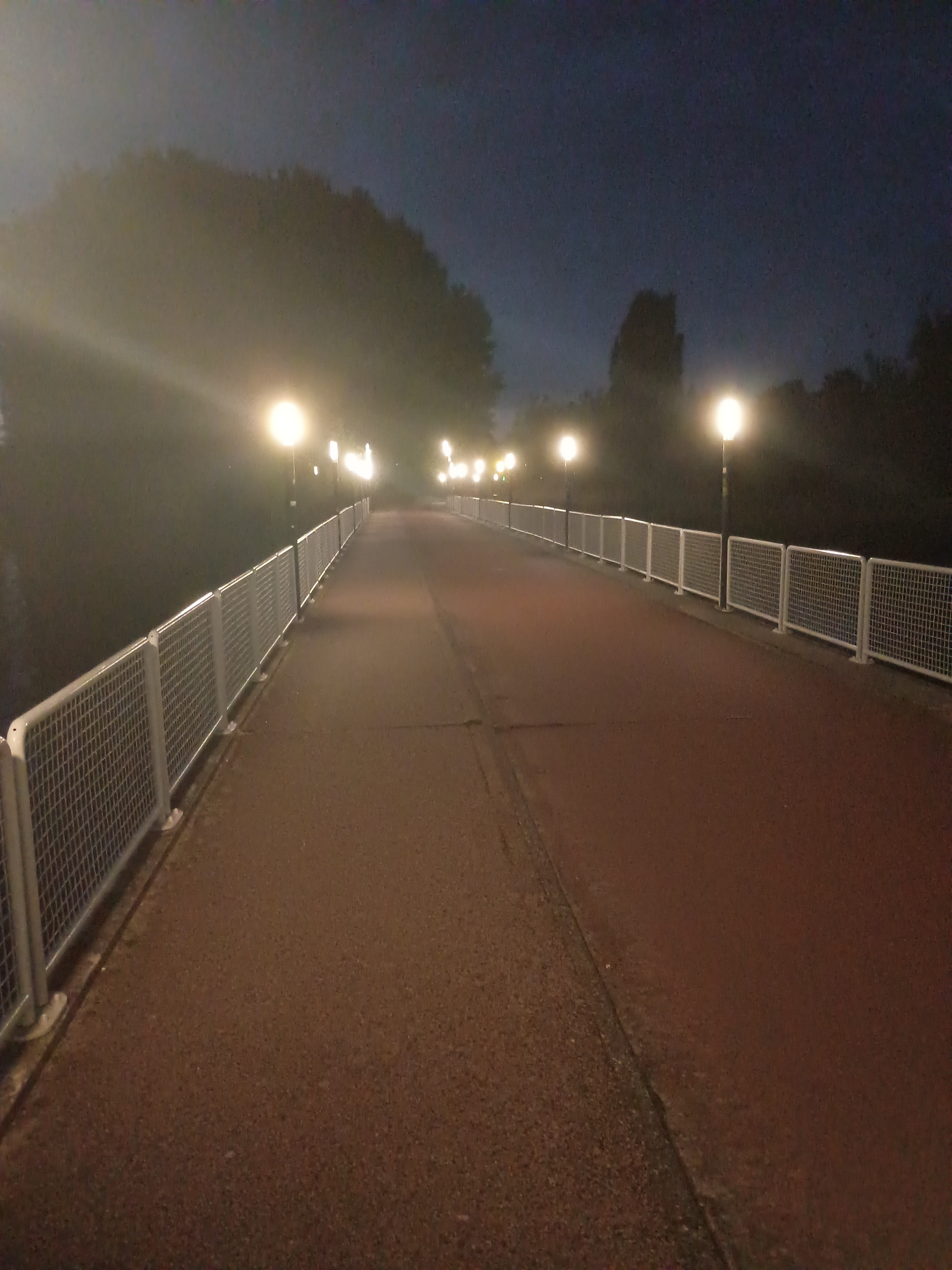
* **Dual-colored path:** The path is divided into a red asphalt section (likely a cycle lane) and a darker grey/black section (pedestrian). This is a common design for the Greenway in London.
* **Globe streetlights:** Distinctive spherical lamps on simple dark poles. These were installed specifically for the Greenway regeneration project.
* **Mesh fencing:** High, rectangular mesh panels with a top rail. While they appear white here due to night exposure/glare, they are galvanized steel.
* **Environment:** The path is elevated (a bridge), indicated by the railings on both sides and the lack of adjacent ground-level features. The "fog" or mist is typical for river crossings in this damp, low-lying area of East London.
* **Vegetation:** Dense, dark tree canopies in the background match the wooded sections of the Lea Valley Park and the areas bordering the Greenway between Stratford and West Ham.
Reasoning
The combination of the red/black divided path and the specific globe lighting strongly points to **The Greenway** in East London. This path runs on top of the Northern Outfall Sewer.
1. **Narrowing the stretch:** The Greenway runs from Victoria Park to Beckton. The red/black split is most prominent in the Newham section, particularly around the Olympic Park (Stratford).
2. **Determining the side:** West of the A12, the red cycle path is on the north side of the embankment. East of the A12 (towards West Ham/Beckton), the red path is on the south side. In the photo, if the red path is on the right, the camera must be facing **East** (South is to the right).
3. **Identifying the bridge:** On the section east of the A12, there are several bridges. The bridge over the **Waterworks River** is a major crossing. Looking East from this bridge, the path enters a more densely wooded section near Marshgate Lane and the "Abbey Creek" area, which matches the dark background trees seen in the photo.
4. **Alternative:** The bridge over the City Mill River is nearby, but it is shorter. The length of the bridge in the photo and the perspective suggest the wider crossing of the Waterworks River.
Verification
* **The Greenway (London) - Wikipedia:** Mentions the 2012 Olympic improvements including the new paving and lighting. Wikipedia Link
* **Google Street View:** Confirms the red/black path, globe lights, and galvanized mesh fencing on the bridge over the Waterworks River. Facing East, the red path is on the right. Google Maps Street View
Links
• Google Maps (Waterworks River Bridge on the Greenway)
• The Greenway - Newham Council
Coordinates
51.533267, -0.007421 (Looking East)