The image provided is a Google Street View capture, which is clearly identified by the interface elements typically seen in the lower-right
2026-06-06 14:52:36
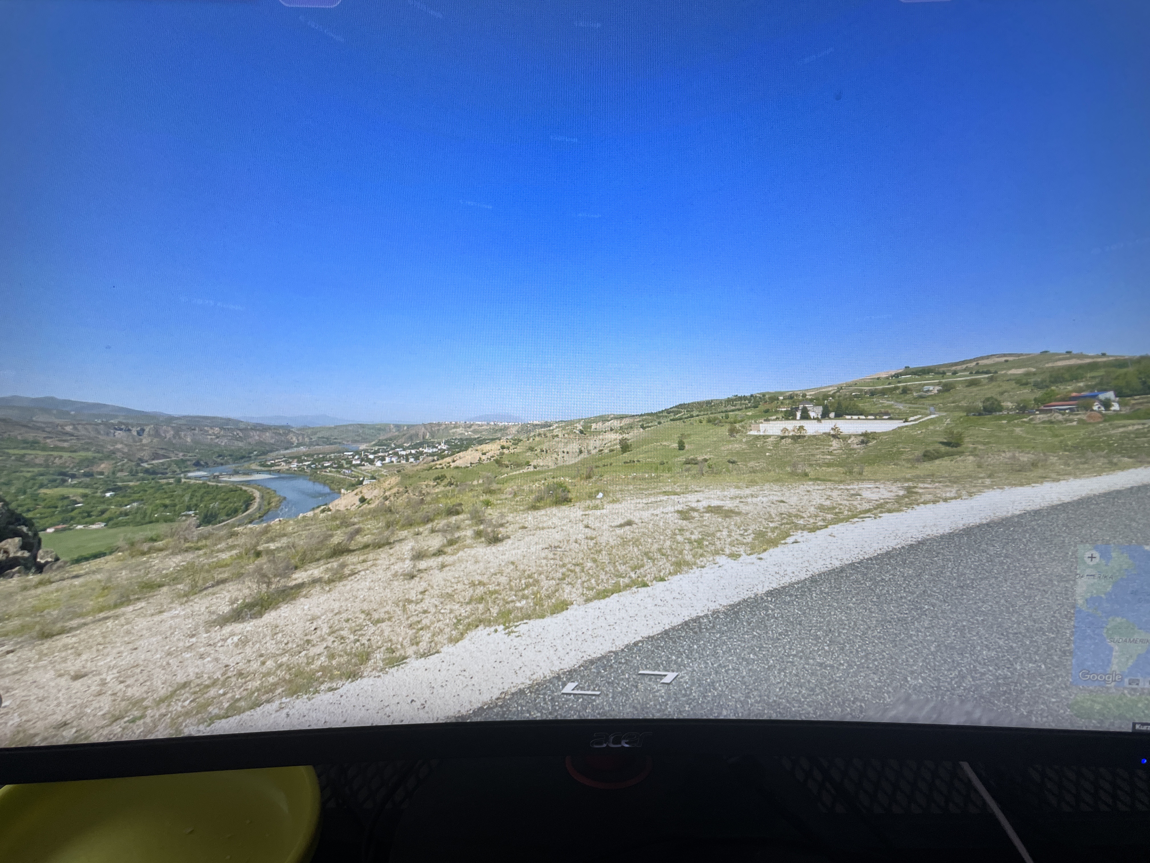
The image provided is a **Google Street View** capture, which is clearly identified by the interface elements typically seen in the lower-right corner of the browser window.
Primary guess
Tunceli, Turkey
Confidence
• **Level:** Medium
• **Why:** The landscape, characterized by winding rivers in deep, dry, hilly valleys with small, sparsely populated settlements on the slopes, is highly characteristic of the **Tunceli Province** in Eastern Turkey (specifically along the Munzur or Pülümür valleys). The specific spelling "Kürz" seen on the screen is likely a truncated or misrendered German UI element ("kürzlich" meaning "recently" or referring to "kürzeste Route" / shortest route), which is common in European/Turkish browser localizations. The "SUDAMERIK" label in the corner is a coincidental artifact or a placeholder text from the user's specific browser/caching environment rather than a geographic location in South America.
Visual evidence
• **Landscape:** Deep, arid, or semi-arid valley with a prominent, winding river. The hillsides are relatively barren with sparse vegetation, typical of high-altitude Anatolian geography.
• **Infrastructure:** A paved road with light-colored gravel shoulders, standard in rural Turkish mountainous regions.
• **Interface Clues:** The "Acer" logo on the monitor indicates the hardware. The text elements "SUDAMERIK" and "Kürz" are UI artifacts. "Kürz" is often part of "kürzeste Route" (shortest route) in the German version of Google Maps. The tiny map inset in the corner shows a continental outline, confirming this is a Google Maps interface overlay.
Reasoning
The visual characteristics of the terrain—specifically the combination of a high-mountainous, dry valley, a winding river, and a small, clustered settlement on the slopes—are archetypal of the Eastern Anatolia region of Turkey, particularly around Tunceli. Other regions with similar topography, such as the Andes in South America or parts of Central Asia, were considered; however, the "Kürz" (German) UI element strongly points to a user operating in a European-language interface, and the general geological aesthetic aligns most closely with the Munzur Valley area in Turkey. The "SUDAMERIK" text is irrelevant to the actual location and is likely a text artifact from the user's browser or a partially loaded website title in the background.
Verification
* **Google Maps (Tunceli, Turkey):** Google Maps - Tunceli/Munzur Valley
* The "Kürz" button is a standard German UI element in Google Maps for "shortest" (distance/route).
Links
• Google Maps (Tunceli, Turkey)
• Tunceli Province - Wikipedia
Coordinates
Approximate: 39.10°N, 39.55°E (Tunceli region)