The photo displays a tranquil, riverside walking path lined by a grass-covered embankment on the right and a river on the left. In the backg
2026-06-04 21:11:22
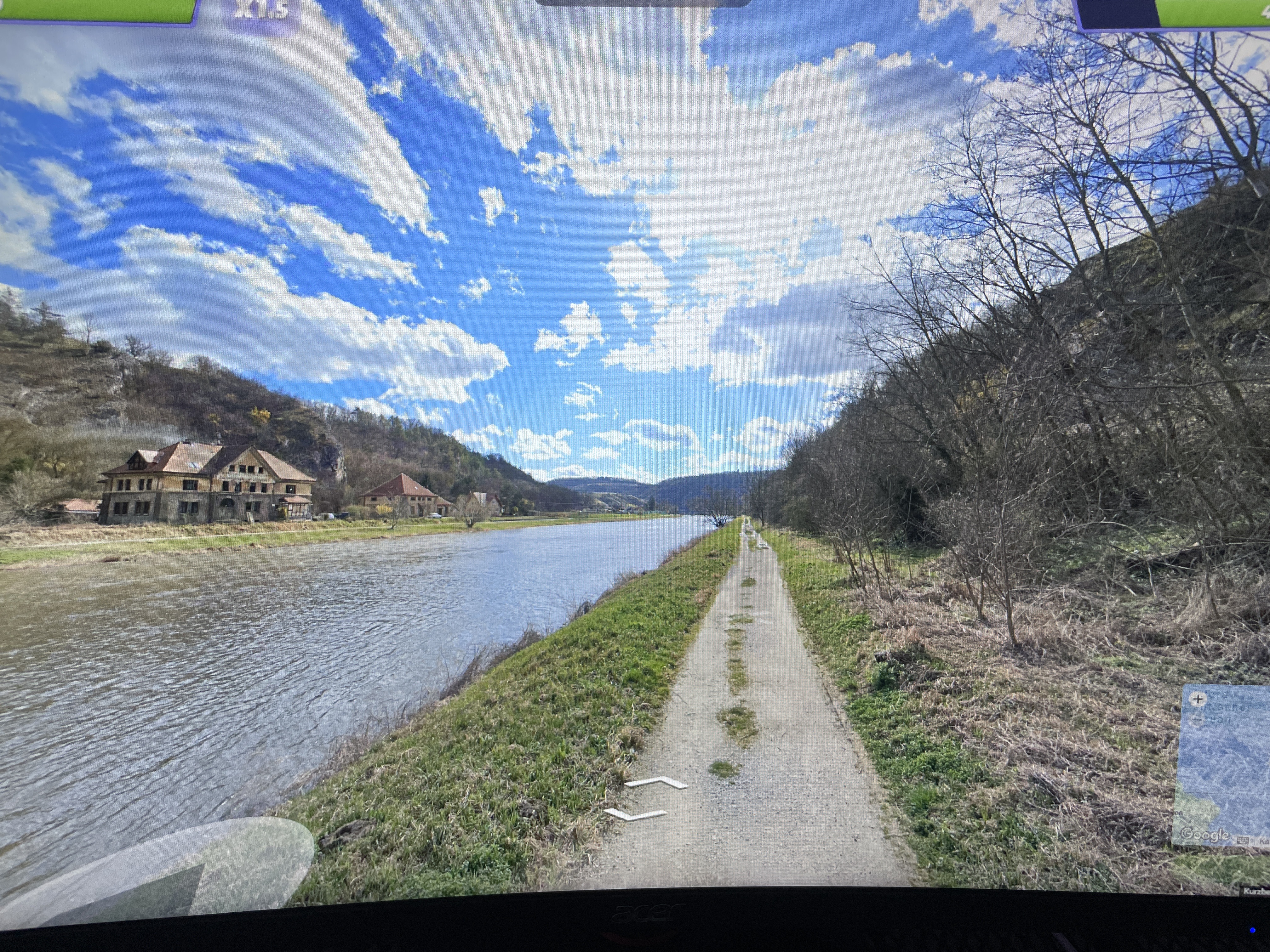
The photo displays a tranquil, riverside walking path lined by a grass-covered embankment on the right and a river on the left. In the background, a substantial building with a terracotta-style roof and stone-colored facade sits on the riverbank, nestled near a steep, partially wooded cliff. The sky is clear blue with scattered white clouds, suggesting a temperate climate.
The image contains a **"X1.5"** icon in the top-left corner, which is a common playback speed control found in various video or gaming interfaces (e.g., simulations or walk-through videos). The text **"Kurzbe"** visible in the bottom-right corner is a truncated German word, most likely "Kurzbeschreibung" (meaning "short description"), which often appears in automated reports, map-related overlays, or project documentation interfaces.
Primary guess
Werra river near Creuzburg, Germany
Confidence
• Level: Medium
• Why:
- The architectural style of the building (large, multi-story, steep roof) and the surrounding landscape (river flowing past a steep, forested limestone/sandstone cliff) are highly characteristic of central German river valleys, particularly the Werra valley in Thuringia.
- While the specific image could be from a video, the visual features align with known locations like the Werra river banks, specifically near the town of Creuzburg, where similar paths and historic/large structures exist along the river.
- The "Kurzbe" text is German, providing a strong cultural and geographic hint that the location is in a German-speaking country.
Visual evidence
• **Architecture:** The building features a classic central European construction style—likely a historic mill, manor, or monastery—common in German river valleys.
• **Geography:** The combination of a wide river, a flat walking/maintenance path, and a high, steep, forested cliff is a classic feature of the Thuringian or Hessian river landscapes in Germany.
• **Language/Overlay:** The snippet "Kurzbe" (truncated from "Kurzbeschreibung") confirms the interface language is German, which narrows the search area significantly.
• **Climate/Vegetation:** The deciduous trees and green grass indicate a temperate climate, consistent with spring or early autumn in Central Europe.
Reasoning
The visual evidence points toward a river landscape in Central Germany. The "Kurzbe" text strongly suggests the source of the image (or the software being used to view it) is German. Comparing the topography (river, embankment path, steep forested slope) to regions in Germany, the Werra valley is a prime match. The building's appearance is consistent with historic structures found in that area. Alternative locations like the French Seine or other major European rivers are less likely due to the specific combination of the natural "steep cliff" and the rural/semi-rural setting of the building.
Links
• Werra River
• Creuzburg (location reference)
Coordinates
Approximate location: 51.05°N, 10.25°E (Region of the Werra Valley, Thuringia, Germany).