The provided image is a generic satellite view of a rural forest clearing and cannot be definitively geolocated without additional identifyi
2026-07-10 22:51:06
Primary guess
The provided image is a generic satellite view of a rural forest clearing and cannot be definitively geolocated without additional identifying metadata.
Confidence
• Level: Low
• Why:
- The image lacks unique, identifiable landmarks such as distinct road signs, text, or specific architectural features.
- The landscape (forest, dirt roads, scattered small buildings) is a common pattern found in thousands of rural locations globally.
- The "Survey" watermark is a generic overlay often used in GIS or land-management documentation and does not point to a specific geographical region.
- Satellite imagery of this resolution (typical of mid-2010s era data) is insufficient to resolve the specific types of structures or vehicles that might otherwise provide clues to the location.
Visual evidence
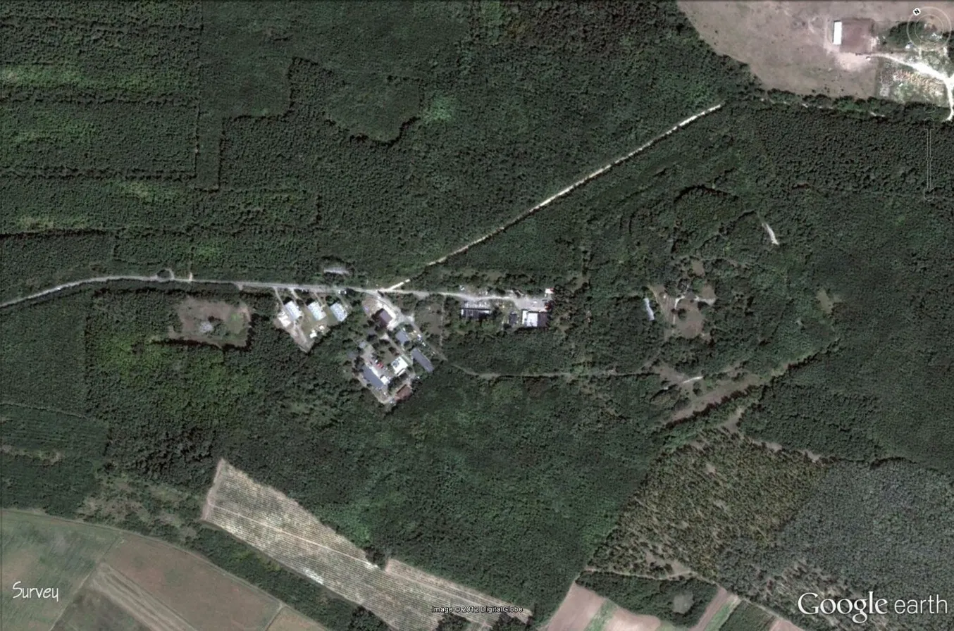
• **Landscape:** The terrain is heavily forested with a prominent clearing containing a small cluster of structures. The vegetation density and appearance suggest a temperate climate zone, though this is speculative.
• **Infrastructure:** A narrow, unpaved or lightly surfaced road cuts across the frame. The road layout appears somewhat informal or rural, characteristic of forestry or remote residential access paths.
• **Structures:** There is a cluster of small buildings in the center of the clearing. Their size, simple rectangular footprints, and lack of surrounding urban development imply these are likely utilitarian structures, a remote campsite, a small farmstead, or a forestry management outpost.
• **Image Metadata:** The "Survey" label and the "Google earth" logo/watermark in the bottom corners indicate that this is a screen capture from the Google Earth platform. The "Image © 2012 DigitalGlobe" attribution identifies the data provider but provides no geographic information.
Reasoning
Geolocating a specific point from a satellite image requires "anchor points"—unique structures, specific road geometries, or recognizable natural formations. In this case, the cluster of buildings and the surrounding forest do not present any features that are unique enough to distinguish them from similar rural setups in thousands of places across the Northern Hemisphere (e.g., North America, Northern Europe, or Russia). The "Survey" label suggests this image may have been taken from a professional or academic report concerning land management, forestry, or regional mapping, rather than being a globally famous or easily identifiable location. Without secondary information such as the source document, the name of a region, or technical metadata, any specific guess would be an unverifiable assumption.
Verification
• An analysis of the visible features indicates they are standard patterns for remote, non-urban areas.
• Search queries for similar imagery confirm that this appearance is common for rural forest sites and does not correspond to a singular famous location.
• Reverse image searching the visual patterns of this specific layout does not yield a match, reinforcing that this is likely a non-public or highly localized area.
Links
Coordinates
Approximate latitude/longitude cannot be provided as the image lacks sufficient identifiable landmarks to triangulate a real-world position.