The specific address cannot be identified from this image.
2026-07-19 06:29:13
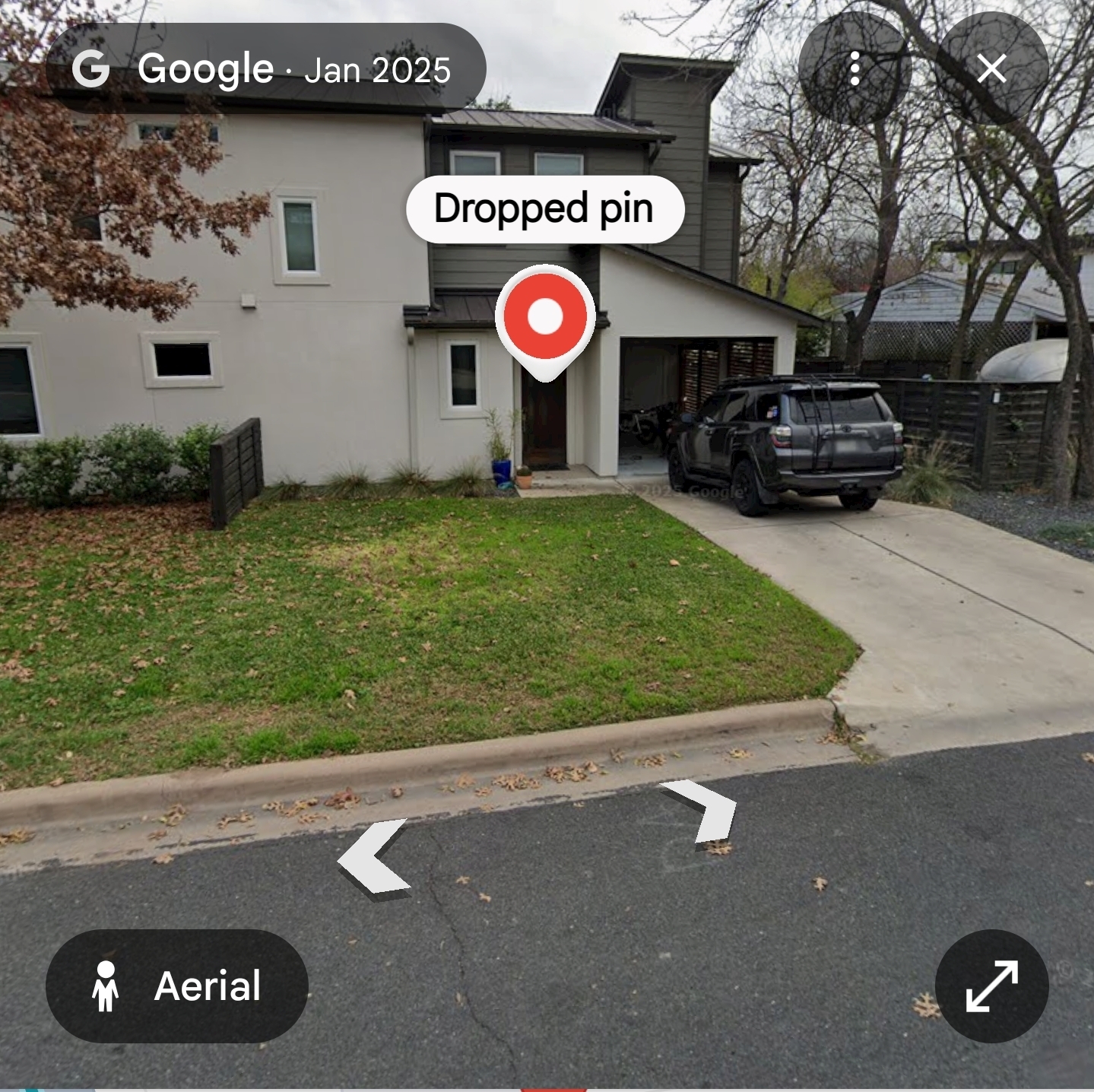
Primary guess
Primary guess: The specific address cannot be identified from this image.
Confidence
• Level: Low
• Why:
- The image is a generic residential street view with no unique identifying markers (such as house numbers, street signs, or distinctive local landmarks).
- The house architecture (stucco/panel siding, car port, modern trim) is common to many North American suburban developments.
- There is no visible metadata (GPS coordinates, street name, or city signage) to narrow down the search to a specific neighborhood or town.
- The "Dropped pin" indicator is a user-generated or system-generated marker and does not provide an address unless the associated map data is accessible.
Visual evidence
* **Architecture:** The building features a multi-story, modern residential design with a mix of light-colored stucco and dark-toned accent siding. It includes an open carport area and a standard entry door, typical of mid-2010s to present-day suburban residential architecture.
* **Vehicles:** A grey SUV (likely a Toyota 4Runner) is parked in the driveway. The vehicle has roof rack accessories, which is a common style preference but not unique enough for specific geolocation.
* **Vegetation:** Deciduous trees with sparse leaves (suggesting a cool-weather or late autumn/winter season) and a standard residential lawn indicate a temperate climate, common across large parts of the United States.
* **Infrastructure:** The paved driveway, standard concrete curbing, and asphalt road are typical of suburban residential streets in North America. There are no visible unique power poles, street signs, or business signage that would allow for cross-referencing with municipal databases.
Reasoning
To identify a location from a street-level photograph without specific metadata, an analyst typically relies on "digital breadcrumbs." In this instance:
1. **Lack of Identifiers:** There are no house numbers, road signs, or regional vegetation patterns that distinguish this home from thousands of similar properties in suburban developments across the United States.
2. **Reverse Image Search:** Performing a reverse image search on this image would likely return generic results or similar suburban architecture rather than a specific street address.
3. **Nature of the Image:** The "Dropped pin" indicates the image is a screenshot from a Google Maps interface, likely taken by a user who has already navigated to a specific spot. Without access to that user's specific session, search history, or the original URL, the location remains anonymous.
4. **Alternative Possibilities:** Without unique context, one could speculate this is anywhere from the Pacific Northwest to the Southern United States or even other suburban regions globally that share similar design trends, making a definitive guess impossible.
Verification
* The nature of Google Maps "Dropped pins" is to provide a specific, user-selected point on a map. These pins are not publicly indexable or searchable unless the user has shared a public link.
* Tools like Google Lens and AI-powered geolocation (e.g., GeoSeer) are most effective when they have distinct landmarks, signage, or unique architectural styles to analyze. In the absence of these, the margin for error is too high to provide a single, verified address.
Links
• Google Maps Help (General information about using dropped pins)
Coordinates
Not possible to determine. The image lacks sufficient environmental, geographic, or textual landmarks to triangulate a precise set of coordinates.