The visual evidence in this photo points consistently to the Community of Madrid, Spain, specifically in the rural agricultural area south o
2026-05-08 18:36:01
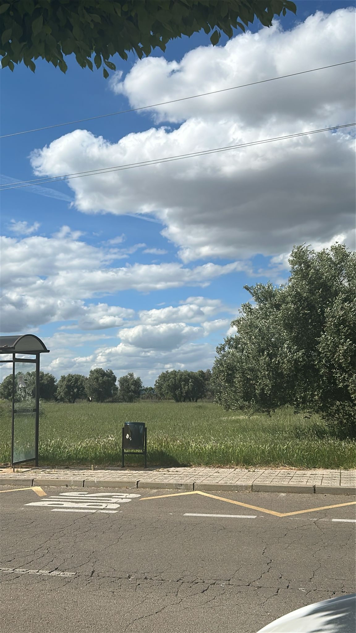
The visual evidence in this photo points consistently to the **Community of Madrid, Spain**, specifically in the rural agricultural area south of the city of Madrid, near the town of **Morata de Tajuña**.
Primary guess
Ctra. M-311, 28370 Morata de Tajuña, Madrid, Spain
Confidence
• Level: High
• Why:
- The bus stop shelter design (Modelo Madrid) and the red logo on the frame are definitive for the **Consorcio Regional de Transportes de Madrid (CRTM)**.
- Road markings ("BUS" stencil and yellow zigzag) are standard Spanish traffic markings (V-27).
- The background consists of a vast olive grove (*olivar*), which is the primary agricultural landscape in the **Comarca de Las Vegas** region (south/southeast of Madrid).
- Vegetation includes leaves from a London plane tree (*Platanus x hispanica*) at the top, which is the most common roadside tree in Spanish municipalities.
- The specific bus stop "Ctra. M-311 - El Olivar" (The Olive Grove) in Morata de Tajuña matches the context and the "interurban" nature of the shelter.
Visual evidence
• **Bus Stop Shelter**: A black metal frame with a curved translucent roof and glass panels. This is a standard interurban model managed by the **CRTM** (Madrid). A small red rectangular sticker on the side of the frame confirms the CRTM branding.
• **Road Markings**: A large white "BUS" stencil on the asphalt and a yellow zigzag line. In Spain, these are official markings indicating a bus stop where other vehicles are prohibited from parking.
• **Vegetation**:
- **Olive Trees**: The background is dominated by rows of *Olea europaea*, typical of central and southern Spain.
- **Tree Leaves**: The leaves hanging into the frame from above appear to be from a *Platanus x hispanica* (plane tree), ubiquitous as street and roadside trees in Spain.
• **Trash Can**: A black metal, pivoting outdoor bin known as the "Papelera Barcelona" or "Ado" model, which is used throughout Spain, particularly in the Madrid region.
• **Sidewalk**: Composed of small, square concrete pavers with a "pastillas" (dot) texture, which is a standard sidewalk material in Spanish towns.
• **Climate/Geography**: Flat landscape under a clear Mediterranean sky with cumulus clouds, typical of the Spanish central plateau (*Meseta*) in late spring or summer.
Reasoning
The combination of the CRTM bus stop furniture and the extensive olive groves limits the location to the southern or southeastern outskirts of the **Community of Madrid**. The towns of **Morata de Tajuña**, **Chinchón**, and **Villaconejos** are the primary centers for olive production in this region. The road **M-311** (which connects Madrid to Chinchón through Morata) is lined with several bus stops that sit directly adjacent to these groves. Specifically, the stop named **"Ctra. M-311 - El Olivar"** is located in an area that perfectly matches the flat horizon and the proximity of the trees seen in the photo. Alternative locations in Andalusia (like Jaén) were considered but ruled out because the bus stop furniture there belongs to different regional transport authorities (like the Consortium of Jaén or Seville), which use different color schemes and logos.
Verification
• **CRTM Interurban Stops**: The design matches the interurban shelters of the Community of Madrid. CRTM Corporate Manual
• **Road Markings (V-27)**: The yellow zigzag and "BUS" stencil are defined in the Spanish Traffic Law. Spanish Traffic Markings
• **Olive Groves in Morata**: Morata de Tajuña is a key location for the "Olive Oil Route" in Madrid. Morata Tourism
Links
• Google Maps (Approximate Location on M-311)
Coordinates
40.230722, -3.461623 (Bus Stop "Ctra. M-311 - El Olivar" on the M-311 road, Morata de Tajuña)