Unidentifiable location (Rural North America)
2026-07-08 03:23:41
Primary guess
Primary guess: Unidentifiable location (Rural North America)
Confidence
• Level: Low
• Why:
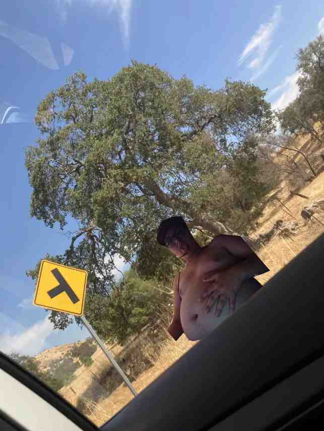
- The image is heavily manipulated/photoshopped, with a person superimposed over the landscape.
- The road sign is a generic "Y-Intersection Ahead" warning sign (MUTCD W2-5) used widely across North America (USA and Canada).
- The terrain (dry grass, oak-like trees) is common in many regions, particularly California, the Pacific Northwest, or parts of the Southern interior of Canada/Western USA.
- There are no unique landmarks, street names, vehicle license plates, or specific geographic markers to narrow down a location.
Visual evidence
* **Road Sign:** The yellow diamond-shaped sign with a black "Y" symbol is a standard "Y-Intersection" warning sign. This confirms the setting is a public roadway but does not point to a specific country or state, as this sign is standard in many jurisdictions.
* **Vegetation:** The presence of dry, golden-brown grass and trees with open, spreading canopies (resembling various species of Oak) is characteristic of Mediterranean-type climates or semi-arid regions frequently found in California, Oregon, or similar latitudes during summer months.
* **Climate/Environment:** The bright, clear blue sky and sunlit, arid terrain suggest a dry, sunny climate typical of rural western North America.
* **Manipulation:** The person in the image is clearly a "cut-out" (digitally inserted), meaning the photo is not a natural depiction of a single location, which further complicates geolocation as the foreground and background may have been sourced independently.
Reasoning
The photo's primary identifying feature is a standard road warning sign found in thousands of rural locations across North America. Because the subject of the photo is digitally superimposed onto the background, any attempt to use the person's position or the lighting to calculate a specific location is invalid. The background scenery represents a generic rural landscape that could be found in thousands of places across states like California, Oregon, Washington, or British Columbia. Without a distinct geographic landmark, license plate, or unique sign text, a precise geolocation is impossible.
Verification
* The sign is identified as a standard **W2-5 "Y-Intersection"** warning sign, used to warn drivers of an upcoming three-way split in the road where all branches are of equal priority.
Links
• MUTCD (Manual on Uniform Traffic Control Devices) - Warning Signs
Coordinates
• Not possible: The image lacks specific geographic identifiers, and the digital manipulation prevents relying on environmental shadows or perspectives for triangulation.