Unknown Residential Location
2026-06-19 12:47:03
Primary guess
Unknown Residential Location
Confidence
• Level: Low
• Why:
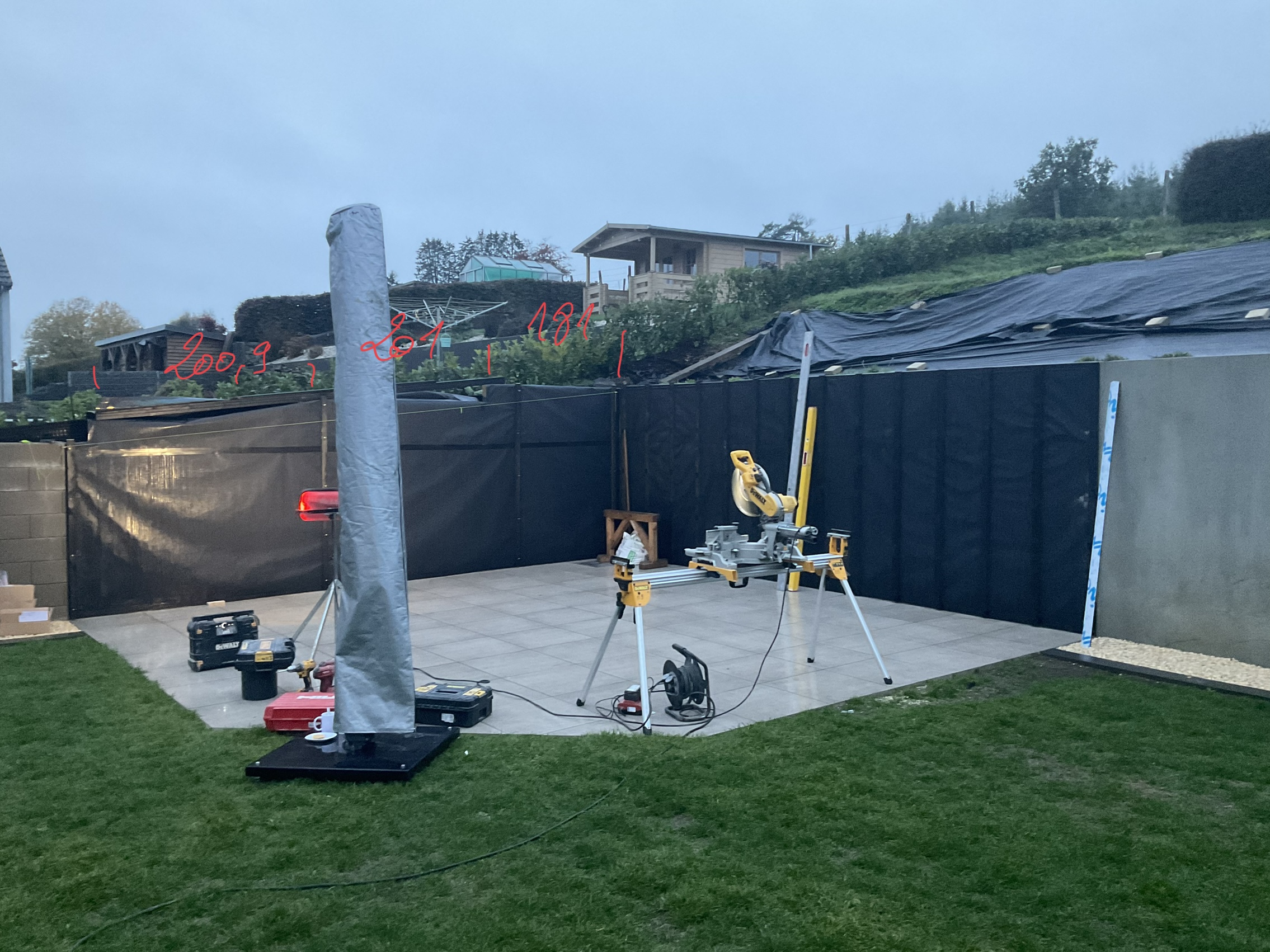
- The numbers "200.9", "201", and "181" appear to be handwritten annotations added to the image after it was taken, likely representing measurements (e.g., distances in centimeters, slope percentages, or project notes) rather than geographic identifiers or addresses.
- The scene is a generic residential backyard under construction, featuring common tools (DeWalt sliding compound miter saw), landscaping materials (black privacy screening/geotextile), and patio tiles. These elements are found worldwide and provide no specific regional markers.
- There are no visible street signs, house numbers, unique architectural styles, or identifiable license plates to anchor the location.
- Search results for these specific numbers in combination consistently point to diverse, unrelated contexts such as technical manuals, statistical data, or height measurements, confirming they are not geographic coordinates or common local identifiers.
Visual evidence
* **Tools:** A DeWalt miter saw on a portable stand indicates active DIY or professional landscaping/construction work.
* **Infrastructure:** The patio is surfaced with large-format, light-colored square tiles. A black privacy screen or construction netting is fixed to a temporary or permanent fence/boundary.
* **Environment:** The background features a sloped terrain covered with a large black landscape fabric (often used for soil stabilization or weed suppression), suggesting significant ongoing earthworks.
* **Architecture:** A wooden, elevated cabin-style structure is visible on the upper level of the hill, which could imply a rural or semi-rural setting, but is not definitive of any specific country or region.
* **Climate:** The overcast, gray sky and muted lighting suggest a temperate climate, likely in the morning or evening, but offer no specific climatic "fingerprint."
Reasoning
The photo depicts a private residential construction or renovation project. The red numbers written on the image are clearly annotations intended to communicate specific information—such as measurements for the patio area, height differences across the sloped terrain, or perhaps instructions for a contractor. Because these numbers are arbitrary to the specific project and not global geographic identifiers, they cannot be used to geolocate the image.
The surroundings (backyard, decking/patio work, sloped hill with fabric) are typical of residential properties in many Western countries (e.g., North America, Europe, Australia). Without further context or identifying features (like a distinct local building style, specialized vegetation, or a clear landmark), it is impossible to determine the exact real-world location.
Verification
* Searches for the number sequence "200.9 201 181" confirm they appear in various disparate contexts (e.g., sports statistics, construction manuals, technical reports) and have no geographic significance.
* Visual inspection confirms the lack of any unique signifiers that would allow for a precise geolocation.
Links
• N/A
Coordinates
• Not possible: The photo lacks any discernible geographic identifiers, landmarks, or regional-specific features.