Utah, United States
2026-07-30 15:17:08
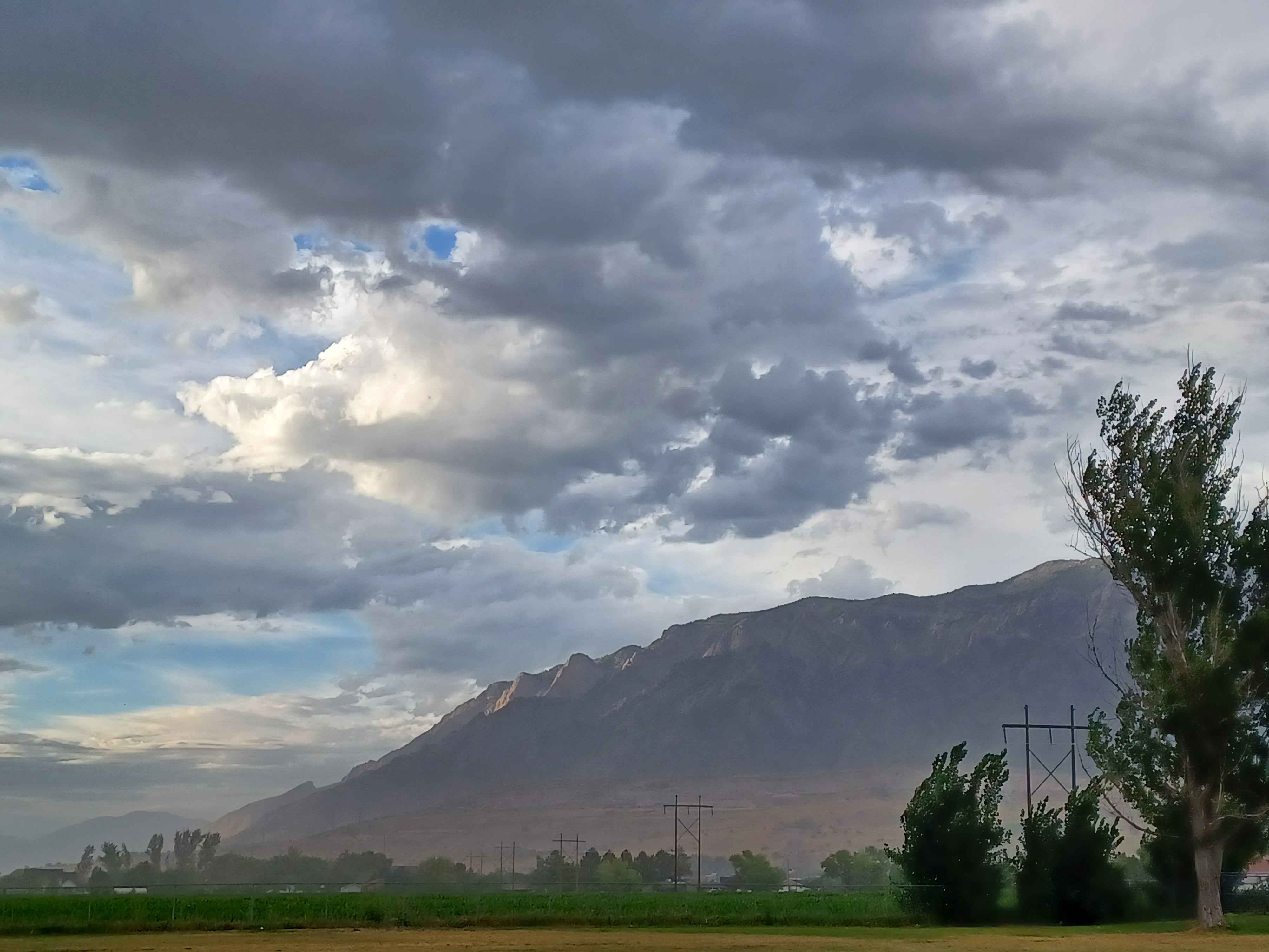
Primary guess
Utah, United States
Confidence
• Level: Medium
• Why:
- The landscape—characterized by high-voltage lattice transmission towers, expansive agricultural fields in a valley floor, and a dramatic, steep mountain range—is highly characteristic of the Basin and Range Province in the Western United States.
- Specifically, the geological feature of "triangular facets" along the base of the mountains is a classic diagnostic feature of the active normal faults found throughout Utah (e.g., the Wasatch Fault).
- The power line infrastructure design is consistent with standard high-voltage transmission lines commonly found in rural/semi-arid regions of the American West.
Visual evidence
• **Geomorphology:** The mountain range exhibits prominent **triangular facets** along its lower slopes. These are distinct, triangular-shaped cliff faces created by the rapid uplift of a mountain block along a normal fault, which truncates the ends of mountain spurs. This is a hallmark of the Basin and Range tectonic regime.
• **Infrastructure:** The high-voltage lattice transmission towers are standard, industrial-scale structures designed to span long distances across flat valleys, commonly seen in rural parts of states like Utah, Nevada, and Idaho.
• **Vegetation/Climate:** The foreground features lush, irrigated green crops (likely alfalfa or corn) in a valley, which strongly contrasts with the arid, dry appearance of the foothills and mountain slopes. This suggests an arid or semi-arid climate where intensive agriculture is only possible via irrigation.
• **Sky/Atmosphere:** The cumulus cloud formations and atmospheric clarity are typical of the interior Western U.S., where large-scale weather patterns often interact with significant topographical barriers.
Reasoning
The visual evidence points strongly toward the American West. The combination of fault-bounded mountain ranges with well-defined triangular facets and high-voltage power lines crossing agricultural valley floors is a "textbook" description of the Basin and Range Province, which covers much of Nevada and Utah.
While similar landscapes exist in other parts of the world (e.g., the Zagros Mountains in Iran or the Taurus Mountains in Turkey), the specific combination of these modern, wide-base lattice transmission towers, the type of irrigation-fed agriculture in the valley, and the specific style of the mountain ridge strongly favors a location in the United States, particularly Utah. Similar photography of the Wasatch Range or areas near Delta, Utah, frequently showcases these exact geomorphic and infrastructural elements. Other locations like the Himalayas or Alps were excluded because their geological signatures (e.g., sharper, glaciated peaks, different forest density) and infrastructure styles differ significantly from the image.
Verification
• Basin and Range tectonic features (Triangular Facets)
• Utah Geological Survey: Fault scarps and triangular facets
Links
Coordinates
Approximate coordinates: 39°30′N 112°30′W (General region of the Basin and Range, Utah). Exact geolocation is not possible as this landscape represents a common, recurring geographical archetype in this region rather than a unique landmark.