Wasatch Range, Utah, USA
2026-07-30 15:05:36
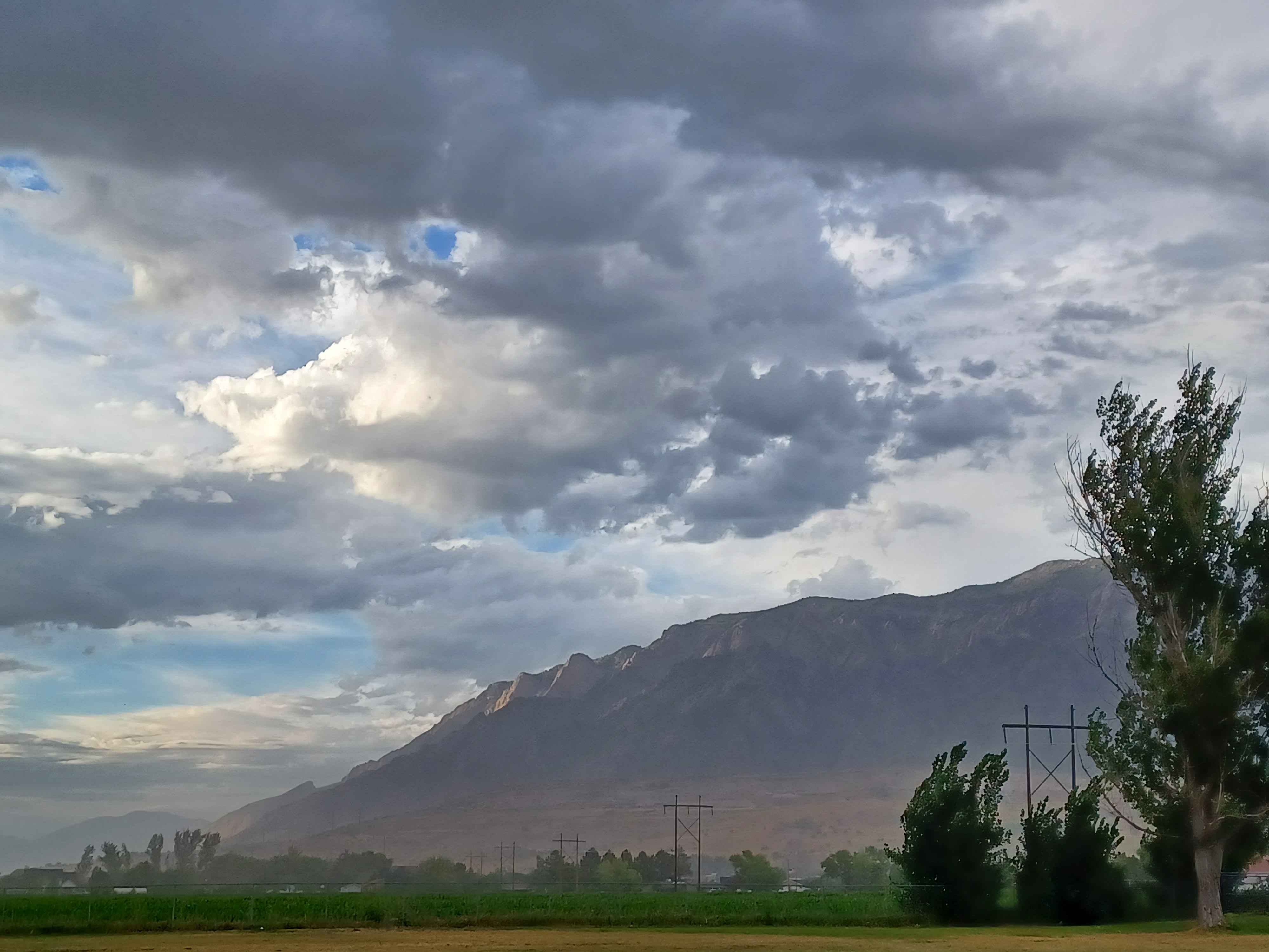
Primary guess
Wasatch Range, Utah, USA
Confidence
• Level: High
• Why:
- The mountain's dramatic, steep rise from a flat valley floor is the iconic signature of the Wasatch Front in Utah.
- The geological appearance (sedimentary/limestone layers) and the "massive" presence are characteristic of major peaks in this range, such as Mount Timpanogos or similar summits.
- The presence of large, high-voltage transmission lines crossing open agricultural or undeveloped valley land is a classic visual element of the Wasatch Front's geography.
- The vegetation (willows/deciduous trees, grasses) and the combination of dramatic clouds over a sunlit ridge are typical of the Utah transition between seasons.
Visual evidence
• **Mountain Profile:** The sharp, steep elevation gain from a relatively flat base is a hallmark of the Wasatch Range where it meets the Great Basin. The light hitting the face of the mountain highlights rock textures consistent with the limestone/sedimentary geology of the region.
• **Infrastructure:** The tall, steel H-frame transmission towers are standard for high-voltage power lines running along the base of these mountains, often seen in the rural-urban fringe of the Utah Valley or Salt Lake Valley.
• **Vegetation:** The foreground shows low-lying grasses and green, shrubby trees typical of irrigated agricultural land or wetlands found at the base of the mountains in Northern/Central Utah.
• **Climate/Atmosphere:** The dramatic, heavy cloud cover with patches of blue sky and bright, directional sunlight is very common in the Wasatch range, which frequently experiences rapid weather changes and "mountain shadows".
Reasoning
The photo displays the classic "Wasatch Front" landscape: a flat, wide valley floor abruptly transitioning into a massive, steep-walled mountain range. This specific visual arrangement—agricultural or open land in the foreground, large power transmission lines, and a towering, rugged mountain wall—is definitive of the region between Provo and Ogden, Utah.
While other ranges in the American West have mountains, the Wasatch Range is uniquely famous for this abrupt, high-prominence rise from an urbanized or agricultural valley. Alternative locations like the La Sal Mountains near Moab are less likely because they usually have a more isolated, "island-in-the-desert" appearance surrounded by red rock, rather than the expansive, flatter valley floors found along the Wasatch. The Uinta Mountains, while taller, generally do not provide this specific "steep wall rising from a flat valley" view in the same way as the Wasatch Front.
Verification
• Wasatch Range Overview
• Mount Timpanogos Geography
• Visit Utah: Wasatch Front & Back
Links
• Google Maps - Wasatch Front, Utah
Coordinates
Approximate latitude/longitude: 40.35° N, 111.75° W (This covers the general Utah/Wasatch Front area where such landscapes are common).