Winding Stairs, Little Missouri River, Ouachita National Forest, Arkansas, USA
2026-05-01 20:34:16
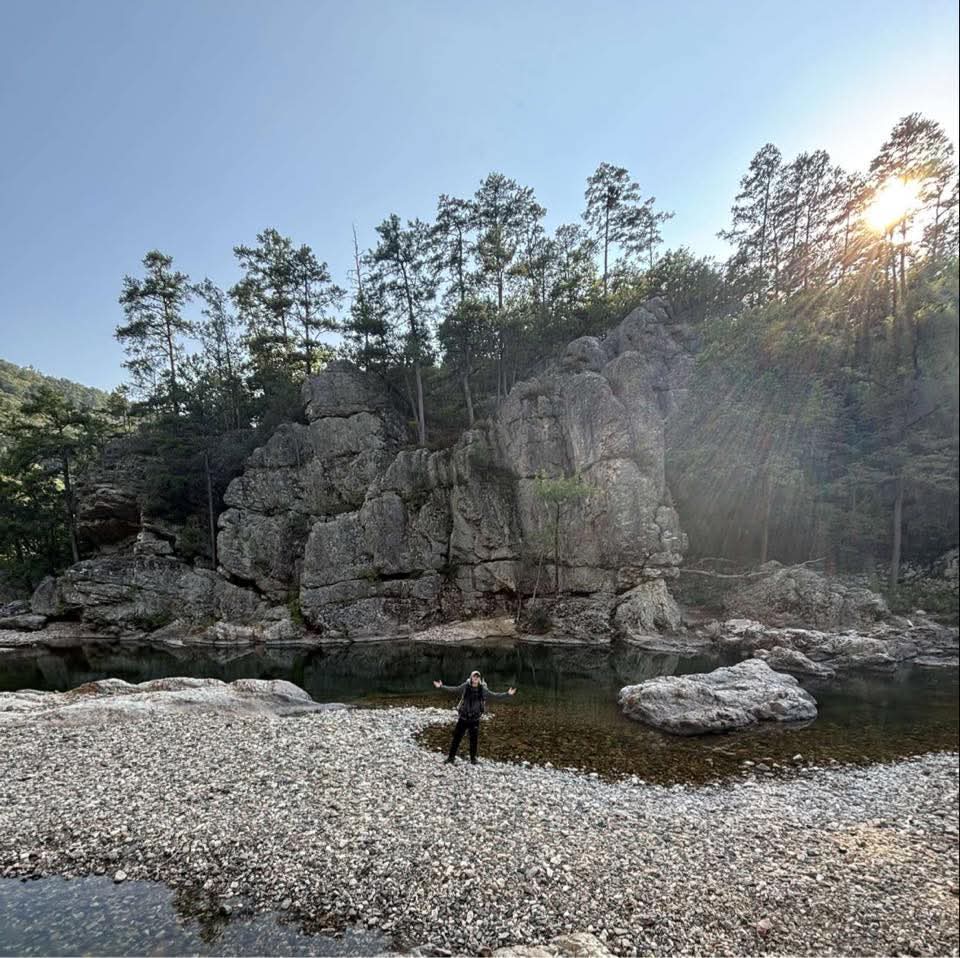
Primary guess
Winding Stairs, Little Missouri River, Ouachita National Forest, Arkansas, USA
Confidence
• Level: High
• Why:
- The rock formation is a perfect match for the distinctive **Arkansas Novaculite** cliffs found at the "Winding Stairs" area of the Eagle Rock Loop.
- The combination of a wide, clear river, a pebbly/gravel beach, and specific vertical blocky rock structures is iconic to this exact swimming hole.
- The person is wearing a large multi-day backpack, consistent with travelers on the famous 26.8-mile Eagle Rock Loop trail.
- Topographical and geological features (novaculite ridges and shortleaf pine forests) are unique to the Ouachita Mountains in western Arkansas.
Visual evidence
• **Geology:** Large, gray, blocky, and stratified cliff face composed of Arkansas Novaculite. This rock type is characteristic of the Ouachita Mountains and resists erosion, creating these sharp bluffs.
• **Vegetation:** Tall, thin pines (likely Shortleaf Pine, *Pinus echinata*) and mixed hardwoods perched atop the rocky ridges.
• **Water Body:** A clear, shallow river with emerald/blue-green deeper pools and a slow current, typical of the spring-fed Little Missouri River.
• **Riverbank:** A wide gravel/pebble bar (gravel bar) where the hiker is standing, common in this section of the Ouachita National Forest.
• **Activity:** The person is carrying a high-volume backpacking pack, identifying this as a wilderness hiking destination rather than a roadside park.
• **Climate/Atmosphere:** Temperate forest setting with clear skies and strong direct sunlight, typical of the American South/Mid-South in spring or autumn.
Reasoning
The photo captures a highly recognizable landmark along the **Eagle Rock Loop**, widely considered the premier backpacking trail in Arkansas. Specifically, this is the **Winding Stairs** area on the Little Missouri River.
1. **Landscape Identification:** The scene shows a classic "mountain river" profile. The blocky, fractured nature of the rock points to the Ouachita Orogeny formations (specifically novaculite). Similar spots in the Ozarks (like the Buffalo River) typically feature taller, smoother limestone or sandstone bluffs with different vegetation.
2. **Trail Context:** The presence of a backpacker in a remote-looking river valley narrowed the search to major backpacking loops. The Eagle Rock Loop is famous for its "Winding Stairs" section, which features exactly this type of scenic swimming hole and river crossing.
3. **Alternative Locations:**
* *Ozark National Forest (Buffalo River):* Bluffs here are usually much taller (hundreds of feet) and made of smooth, light-colored limestone/dolomite.
* *Appalachian Mountains:* Rivers in the Smokies or Blue Ridge typically have more rounded, mossy boulders and denser, darker forest cover (rhododendrons, etc.), which are absent here.
* *Western US:* The vegetation and "softness" of the green hills in the background are too lush for the arid West, and the rock type doesn't match the granite common in the Sierras or Cascades.
Verification
• **Google Maps/Earth:** Satellite imagery of the "Winding Stairs" coordinates (34.3515, -93.9098) shows the sharp bend in the river and the large rock bluff on the western bank.
• **Travel/Hiking Blogs:** Numerous photos from the Eagle Rock Loop show this exact cliff and the rock in the river (visible to the right of the hiker).
• **Geological Description:** The Arkansas Geological Survey describes Arkansas Novaculite as a hard, dense, light-to-dark gray rock that forms the high, narrow ridges of the Ouachita Mountains, matching the visual evidence.
Links
• Google Maps - Winding Stairs Scenic Area
• AllTrails - Eagle Rock Loop: Winding Stairs
• Winding Stairs Hiking Guide - The Froggy Adventures
Coordinates
34.35152, -93.90978