Yemen
2026-08-22 04:33:33
Primary guess
Yemen
Confidence
• Level: Medium
• Why:
- The imagery originates from "Al-Masirah" media, the official television channel of the Houthi movement in Yemen.
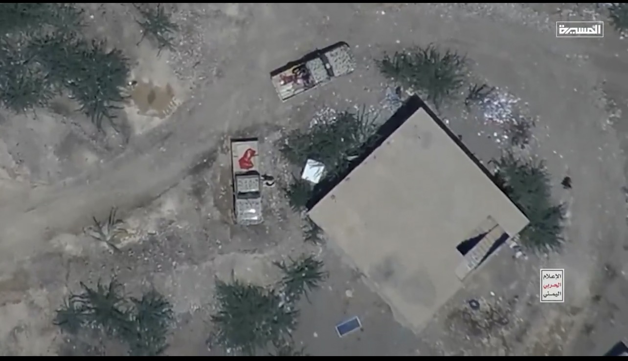
- The scene depicts typical regional infrastructure (desert landscape, simple structures, pickup trucks) consistent with conflict zones in Yemen where Houthi operations occur.
- The presence of a small, solar panel or similar rectangular object on the ground is a common detail in remote, off-grid locations in Yemen.
- While the footage is clearly Yemeni, identifying the *exact* village or coordinate is impossible due to the generic nature of the terrain, which repeats across vast swaths of the Yemeni desert.
Visual evidence
• **Logos**: The "Al-Masirah" (المسيرة) logo in the top right and the "Yemeni Military Media" (الإعلام الحربي اليمني) watermark in the bottom right confirm the source is the Houthi movement's propaganda/media wing.
• **Vehicles**: Two light pickup trucks (technicals) are visible. These vehicles are ubiquitously used by various factions in the Yemeni conflict.
• **Architecture**: A large, plain, square building with a flat roof suggests a simple, functional structure typical of rural or semi-desert areas in Yemen.
• **Landscape**: The arid, rocky, and scrub-covered terrain is characteristic of the Yemeni landscape.
• **Objects**: A small, rectangular, blue-tinted object (likely a solar panel) is visible near the bottom center, which is standard equipment for off-grid power in remote Yemeni regions.
Reasoning
The visual evidence points directly to Yemen, specifically material released by the Houthi movement (Ansar Allah). The "Al-Masirah" branding is a reliable indicator that the footage is produced by Houthi military media. The landscape, construction style, and vehicle types are all consistent with regions such as Marib, Al Jawf, or the outskirts of Taiz, where recent fighting and drone operations have been reported.
Because the landscape is a generic, unpopulated desert area, there are no unique geographical markers (like town names, specific mountain ranges, or landmarks) that would allow for an exact geolocated pin. The footage is typical of the hundreds of clips released by this source showing "strikes" on "enemy positions," which often occur in contested front-line areas that lack distinctive features.
Verification
• Al-Masirah Wikipedia page confirms it as the Houthi-owned television channel.
• Recent reporting (August 2026) confirms active, ongoing usage of this type of drone/missile media by Houthi forces in regions like Marib and the Red Sea coast.
Links
Coordinates
Not possible to determine. The terrain is a featureless arid landscape that is common throughout the desert regions of Yemen, and the image lacks sufficient resolution or unique landmarks for precise triangulation.